


CHEOS: behind the scenes of the Chinese Earth observation system
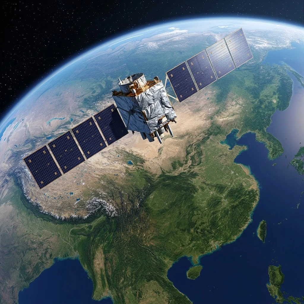
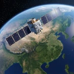
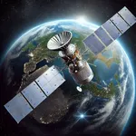
Visualisation of a Gaofen satellite from the CHEOS constellation flying over China, capturing high-resolution images for monitoring resources, disasters and the environment. The luminous streams symbolise the terabytes of data generated daily by this strategic programme.
Image source: astronoo.com (new window) : AI-generated image, public domain.
Summary
Faced with Copernicus, Europe long stood as a pioneer in open and free Earth observation data. But China has developed its own ecosystem: the China High-resolution Earth Observation System (CHEOS), whose Gaofen satellites (“high resolution” in Chinese) are the cornerstone. Officially launched in 2010, CHEOS became, within a decade, one of the most comprehensive observation systems in the world, combining optical, radar and hyperspectral capabilities. This article explores the programme behind the scenes: its satellites, technical capabilities, concrete applications and international deployment strategy, at a time when geospatial data sovereignty is becoming a major geopolitical issue.
Can China compete with Copernicus?
A programme born of strategic ambition
CHEOS was proposed as early as 2006, before being officially launched as one of China's major national scientific and technological projects in May 2010[reference:0]. It is led by the China National Space Administration (CNSA) and the Earth Observation System and Data Center (EOSDC)[reference:1].
Unlike Copernicus, which relies on an open and free data policy, CHEOS was designed from the outset to meet strategic national needs: defence, natural resource surveys, disaster response and prevention[reference:2]. This difference in philosophy has not prevented the Chinese programme from becoming a key player in Earth observation worldwide.
Also worth exploring
Continue your exploration of the Universe with these topics:
The Gaofen constellation: a heterogeneous fleet
Satellites with complementary capabilities
The CHEOS programme successfully launched seven civilian satellites between 2010 and 2020, all named Gaofen (GF)[reference:3]. Each satellite carries different sensors to cover the full spectrum of needs: high-resolution optical, synthetic aperture radar (SAR), hyperspectral, and even laser altimetry.
GF-1 and GF-6 carry both 2-metre panchromatic cameras and 8-metre multispectral cameras, dedicated to land-use monitoring[reference:4]. GF-3 is equipped with a dual-polarisation C-band radar capable of reaching a resolution of 1 metre, mainly for monitoring maritime targets[reference:5]. GF-5 carries six sensors, including a hyperspectral camera and a directional polarisation camera, for the study of the environment and climate: aerosols, clouds and greenhouse gases[reference:6]. Finally, GF-7 has a laser altimeter for three-dimensional mapping and natural resource surveying[reference:7].
Table of the main Gaofen satellites
The table below summarises the characteristics of the main satellites in the civilian Gaofen series, with their resolutions and preferred application areas.
| Satellite | Launch | Type | Resolution | Main application |
|---|---|---|---|---|
| Gaofen-1 | 2013 | Optical | 2 m pan / 8 m multi | Land monitoring |
| Gaofen-2 | 2014 | Optical | 0.8 m pan / 3.2 m multi | Urban planning, mapping |
| Gaofen-3 | 2016 | Radar (C-band) | 1 m | Marine surveillance, all-weather |
| Gaofen-4 | 2015 | Geostationary optical | 50 m | Continuous observation of an area |
| Gaofen-5 | 2018 | Hyperspectral | 30 m | Atmosphere, climate, air quality |
| Gaofen-6 | 2018 | Optical | 2 m pan / 8 m multi | Agriculture, resources |
| Gaofen-7 | 2019 | 3D mapping | 0.65 m | Surveying, digital models |
Technical capabilities on a par with the best systems
High spatial, spectral and temporal resolution
CHEOS aims to build an Earth observation system with high spatial, temporal and spectral resolution, capable of operating day and night and in all weather conditions[reference:8]. The spatial resolution of Gaofen satellites reaches levels comparable to the best Western systems: GF-2 offers a panchromatic resolution of 0.8 metre, and some satellites in the military series (GF-11) are said to go below 0.5 metre[reference:9].
The hyperspectral resolution of GF-5 makes it possible to quantitatively describe the physical properties of land cover using hundreds of narrow spectral bands, from ultraviolet to near-infrared[reference:10]. Temporal resolution, essential for tracking subtle changes, is ensured by the diversity of orbits and the complementarity of sensors.
Concrete and strategic applications
Resources, disasters and security
Gaofen data feed applications in fields as varied as urban planning, disaster monitoring, agricultural assessment and environmental protection[reference:11]. The programme aims to provide real-time, all-weather observation data for disaster prevention and emergency response, particularly for landslides, typhoons and torrential rain[reference:12].
CHEOS also plays a key role in the “Belt and Road” initiative, by providing observation data for partner countries, and in nationwide environmental monitoring[reference:13]. Control of these data reduces China's dependence on foreign commercial providers and strengthens its strategic autonomy[reference:14].
The commercial ecosystem: SuperView Neo and beyond
A private offering in full expansion
Beyond the civilian CHEOS programme, China has developed a dynamic commercial ecosystem. The SuperView Neo constellation (四维高景), operated by China Siwei (a CASC subsidiary), combines optical and radar satellites to offer high-resolution services. SuperView Neo 2 (四维高景二号) is a synthetic aperture radar satellite capable of a resolution below 1 metre, operating day and night and in all weather conditions[reference:15].
SuperView Neo 3 (四维高景三号) is presented as China's first optical surveillance satellite combining a swath of more than 130 kilometres and a resolution of 0.5 metre, enabling coverage of vast areas with frequent revisit[reference:16]. This commercial constellation complements the public CHEOS offering and demonstrates the industrial maturity of the Chinese space sector.
Sovereignty and international cooperation
A data policy different from Copernicus
Unlike Copernicus, whose Sentinel data are freely accessible to all, CHEOS does not practise full openness. Gaofen data are distributed under controlled arrangements, depending on users and uses. This approach reflects the Chinese conception of geospatial data sovereignty, considered a strategic asset.
Nevertheless, China is actively developing international cooperation. The CNSA has presented CHEOS at international forums, particularly in Latin America, and offers partnerships within the framework of the space “Belt and Road” initiative[reference:17]. This strategy aims to position CHEOS as an alternative to Western systems for emerging countries.
Key takeaways
CHEOS is no longer an emerging programme: it is an operational reality that places China among the major powers in Earth observation. With its seven civilian Gaofen satellites, its optical, radar and hyperspectral capabilities, and its rapidly expanding commercial ecosystem, China now has a complete infrastructure to monitor its territory and export its expertise.
The comparison with Copernicus is illuminating: where Europe relies on openness and free data, China prioritises strategic control and sovereignty. These two models do not directly oppose each other, but they outline two visions of geospatial data governance on a global scale. The question is no longer whether China can compete with Copernicus, but under what terms and with which partners it will do so.
References
- eoPortal - Gaofen-1 (GF-1), first satellite of the CHEOS programme (new window)
- UN-SPIDER (UN) - China launches Gaofen satellites for disaster alert (new window)
- Spaceflight Now - Launch of the Gaofen 12-02 Earth observation satellite (new window)
- Wikipedia - Gaofen, the satellite series of the CHEOS programme (new window)
FAQ: CHEOS and Earth observation in China
What is the CHEOS programme?
CHEOS (China High-resolution Earth Observation System) is China's high-resolution Earth observation programme. Officially launched in 2010, it brings together the civilian Gaofen satellites and aims to provide data for defence, natural resources, disaster response and environmental monitoring[reference:18].
What is a Gaofen satellite?
Gaofen (高分) means “high resolution” in Chinese. It is the generic name for the satellites of the CHEOS constellation, which carry optical, radar or hyperspectral sensors for Earth observation[reference:19].
How many Gaofen satellites have been launched?
The CHEOS programme successfully launched seven civilian satellites between 2010 and 2020: GF-1 to GF-7. Other satellites, notably military (GF-8 to GF-11) and commercial, complete this constellation[reference:20].
What are the capabilities of the Gaofen satellites?
They offer resolutions ranging from 0.5 to 8 metres depending on the sensors, all-weather radar capabilities (GF-3), hyperspectral capabilities (GF-5) and 3D mapping (GF-7). This diversity makes it possible to cover a wide spectrum of applications[reference:21].
Is CHEOS open to international cooperation?
Yes, but under arrangements different from Copernicus. China offers partnerships, particularly within the framework of the space “Belt and Road” initiative, but does not practise full, free openness of data[reference:22].
What is the difference between CHEOS and Copernicus?
The main difference lies in the data policy: Copernicus offers free and open access to all its Sentinel data, while CHEOS favours strategic control of Gaofen data, depending on uses and users. Both programmes nevertheless aim for comprehensive coverage and high resolution.
Does China have commercial Earth observation satellites?
Yes. In addition to CHEOS, commercial constellations such as SuperView Neo (四维高景) and Jilin-1 offer high-resolution optical and radar imaging services for public and private clients[reference:23].
What is the future of CHEOS?
The programme continues to expand with the launch of new satellites, the development of commercial constellations and the strengthening of international cooperation. The objective is to keep China at the level of the best systems in the world and to export its model of geospatial data governance.
 Earth observation: behind the scenes of the Russian programme
 ISRO: behind the scenes of India's Earth observation programme
 Landsat, USGEO, ESO: the American Earth observation ecosystem
 CHEOS: behind the scenes of the Chinese Earth observation system
 Copernicus: behind the scenes of the largest Earth observation programme
 How to Spot Starlink Satellite Trains in the Sky?
 AI, the Astronomer's New Eye: From Analysis to Cosmic Prediction
 What
the First Images from Perseverance Show Us: The Surface of Mars, As If We Were There
 GRAIL
Twin Probes: Mapping the Moon's Hidden Interior
 Earth Under Surveillance: Observation Satellites
 March 2010: The
Ring of Fire Captured by the SDO Observatory
 Positions of Space Probes in 2025
 Giants of Observation: The Largest Ground-Based Telescopes
 Low
Earth Orbits and their uses
 Pioneer, first message to extraterrestrials!
 Infrared images: how to make them visible?
 Sputnik 1
and 2: The Dawn of the Space Age
 Lagrange Points: Gravitational Gateways of the Solar System
 Mars Reconnaissance
Orbiter: The Lynx Eye Revealing Martian Secrets
 Kepler:
4,000 Worlds and More, A New Map of the Sky
 Cheops
Space Telescope: A New Vision on Exoplanets
 The world of Planck
 Rosetta
Space Probe: Comet Churyumov-Gerasimenko
 The
Hubble Space Telescope: Three Decades of Revelations
 Première photo du télescope Hubble
 Satellites that measure underwater relief
 MESSENGER:
The First Probe to Visit the Mysterious Planet
 How GPS Locates
Your Position at Any Time?
 The ISS and Beyond? Towards the End of a Space Chapter
 Space Telescopes: Humanity's Eye Beyond the Atmosphere
 Space
Probes: Interplanetary Travelers and Beyond
 The GAIA
satellite maps the Milky Way
 How
to calculate the synchronous orbit?
 E-ELT: The World's Largest Optical Telescope
 Mercury probes
 Space
debris: the nightmare of operational satellites
 Aquarius:
A Mission to Map Ocean Salinity
 JWST:
An Unprecedented Look at the First Lights of the Universe
 METEOSAT: A Key Satellite for Climate Monitoring
 Curiosity, the first shovel, sample of Martian soil
 From
Mariner to Perseverance: Successes and Failures of Mars Probes
 Where is the geostationary orbit?
 MOM, the
technological demonstration
 Venus under surveillance: an overview of space probes
 What Is an Astronomical
Interferometer?
 The Philae Robot and the Rosetta Comet
 Mauna
Kea Under the Stars: The CFHT Telescope in Pursuit of the Universe's Mysteries