


Landsat, USGEO, ESO: the American Earth observation ecosystem
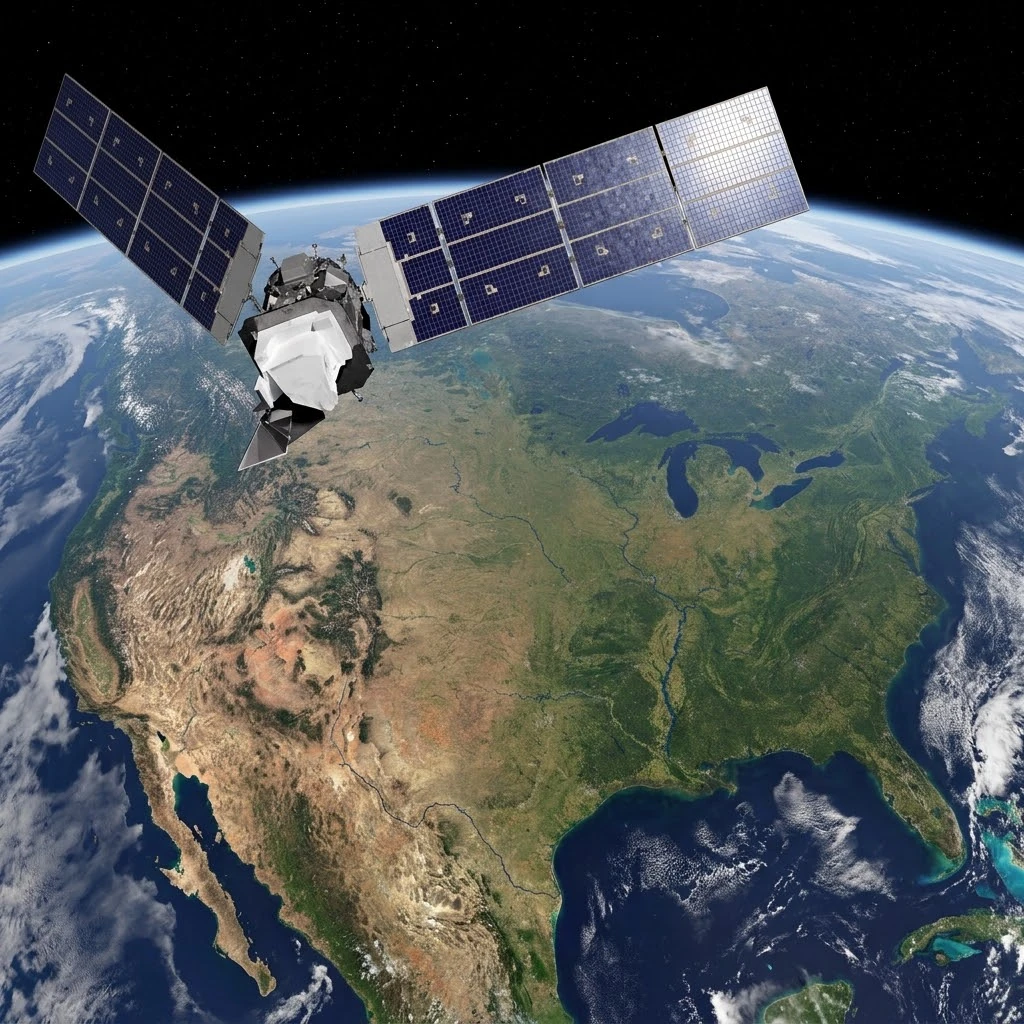
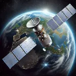
Visualization of a Landsat satellite, cornerstone of American Earth observation since 1972, flying over the North American continent. The luminous flows symbolize decades of open data that fuel research, resource management and public decision-making.
Image source: astronoo.com (new window) : AI-generated image, public domain.
Abstract
Unlike Copernicus, which relies on a single, centralized program led by the European Union, the United States has developed a decentralized, multi-agency architecture for Earth observation. The Landsat program, the result of a partnership between NASA and the USGS, is its historical pillar with more than fifty years of continuous archives and open data since 2008. Around it gravitate NASA's scientific missions (EOS program, ESO), the operational satellites of NOAA (GOES, JPSS), the coordination framework USGEO, and a thriving commercial sector (Planet, Maxar). This article explores the inner workings of this ecosystem, its strengths, its limitations and its strategy in the face of Copernicus's rise.
Do the United States really have a "Copernicus"?
A question of definition
The question deserves to be asked, because the answer is not simple. Copernicus is an integrated program: a single brand, a common data policy, governance centralized by the European Commission and the ESA. The United States, for its part, does not have a single program bearing that name. Instead, it possesses an ecosystem of Earth observation, distributed among several federal agencies, university laboratories and private companies.
This ecosystem is no less powerful than Copernicus. It is simply organized according to a different logic: that of institutional specialization and complementarity between civil, scientific and commercial missions. Landsat is its most visible symbol, but it is only one piece of a much larger system.
Also worth exploring
Continue your exploration of the Universe with these topics:
Landsat: the historical pillar and the functional equivalent
More than fifty years of continuous archives
The Landsat program is the world's oldest satellite Earth observation program. Launched in 1972 with Landsat 1, it is jointly managed by NASA and USGS. Since then, it has provided a continuous record of the land surface, making it a global scientific reference[reference:0].
In 2008, the USGS made a revolutionary decision: to open the entire Landsat archive to the public, free of charge. This decision removed the major historical obstacle to the massive use of the data and preceded the opening of Copernicus data by several years[reference:1]. Today, Landsat is often described as the functional equivalent of Sentinel-2 for the observation of emerged land, with comparable spatial resolutions (15 to 30 meters) and a similar open data policy[reference:2].
Landsat Next: the succession is assured
The program is already preparing for the post-Landsat 9 era. As part of the Sustainable Land Imaging (SLI), NASA and USGS are developing Landsat Next, a constellation of three satellites to be launched together around 2030-2031. These satellites should collect about 15 times more data than current missions, with a richer spectral coverage and an increased revisit frequency[reference:3].
The table of Landsat generations
The table below summarizes the main generations of Landsat sensors, their characteristics and their scientific contribution.
| Generation | Satellites | Sensor | Resolution | Key contribution |
|---|---|---|---|---|
| 1st | Landsat 1-3 | MSS | 80 m | First multispectral archives |
| 2nd | Landsat 4-5 | TM | 30 m (VIS-SWIR), 90 m (TIR) | Spectral and thermal improvement |
| 3rd | Landsat 7 | ETM+ | 15 m pan, 30 m multi, 60 m TIR | Addition of a panchromatic band |
| 4th | Landsat 8-9 | OLI / TIRS | 15 m pan, 30 m multi, 100 m TIR | New blue and SWIR bands |
| 5th | Landsat Next (2030) | Constellation of 3 satellites | Improved resolution and revisit | Data volume multiplied by 15 |
The coordination framework: USGEO and the National Plan
Inter-agency governance
If the United States has no single program, it does have a coordination mechanism: the United States Group on Earth Observations (USGEO). Created under the auspices of the NSTC and the White House Office of Science and Technology Policy (OSTP), it is co-chaired by NASA, NOAA and USGS[reference:4].
USGEO's mission is to plan, assess and coordinate federal Earth observation activities, to promote data interoperability and to identify user needs. It periodically publishes a National Plan for Civil Earth Observations, the latest edition of which dates from December 2024[reference:5]. This plan defines strategic priorities and ensures the coherence of the entire system.
NASA's scientific missions: EOS and ESO
From the EOS program to the Earth System Observatory
Beyond Landsat, NASA leads a vast program of scientific Earth observation missions. The EOS (Earth Observing System) program, launched in the 1990s, gave rise to iconic satellites such as Terra and Aqua, equipped with the MODIS sensor, a 36-spectral-channel instrument that has become a reference for the study of the atmosphere, oceans and emerged land[reference:6].
NASA is now preparing the Earth System Observatory (ESO), a set of interconnected missions designed to provide a holistic, three-dimensional view of the Earth, from the ground to the top of the atmosphere. ESO relies on five priority observation domains identified by the decadal report of the National Academies of Sciences: surface biology and geology, aerosols, clouds and convection, water mass and ice, and atmospheric winds[reference:7].
The table of NASA's flagship missions
The table below presents some of NASA's major scientific missions in Earth observation, whether active or in development.
| Mission / Program | Status | Domain | Main contribution |
|---|---|---|---|
| Terra / Aqua (EOS) | Active | Atmosphere, oceans, land | MODIS, global reference |
| OCO-2 | Active | Atmospheric carbon | Measurement of CO₂ from space |
| Earth System Observatory | In development | Climate, surfaces, atmosphere | Holistic 4D view of the Earth system |
| AOS | In development | Aerosols, clouds | Cloud-climate processes |
NOAA's operational satellites
GOES and JPSS: weather and climate in continuous mode
The NOAA operates two complementary families of satellites. The GOES (Geostationary Operational Environmental Satellites) provide continuous coverage of the Western Hemisphere from a geostationary orbit, with high temporal resolution imagery for weather forecasting and hurricane tracking[reference:8].
The JPSS (Joint Polar Satellite System) are polar-orbiting satellites that provide global coverage twice a day, with essential data for numerical weather prediction, storm tracking and climate monitoring[reference:9]. These satellites are not "open" in the Copernicus sense, but their data feed public and commercial services worldwide.
The commercial ecosystem: an American specificity
Planet, Maxar and the others
One of the major differences between the American model and Copernicus lies in the weight of the commercial sector. The United States is home to the world's largest private Earth observation constellations: Planet Labs with its hundreds of small satellites, Maxar (formerly DigitalGlobe) with its WorldView satellites at very high resolution (up to 0.31 meters), as well as BlackSky and Capella Space for radar[reference:10].
NASA and the U.S. government integrate these actors into their system through commercial data purchase programs, such as the CSDA. This hybrid approach, which combines public missions and private capabilities, is a distinctive feature of the American model[reference:11].
Strengths and limitations of the American model
A decentralized but fragmented power
The American model has considerable assets. Landsat offers unmatched historical depth, with more than fifty years of continuous archives. NASA's scientific missions push the frontiers of knowledge, while NOAA's satellites provide daily operational monitoring. The commercial sector, finally, brings a responsiveness and resolution that public programs cannot always match.
But this decentralization has a downside: the absence of a single brand, a single portal and a homogeneous data policy. Users seeking data must navigate between Earthdata (NASA), USGS EarthExplorer, NOAA CLASS and commercial platforms. This fragmentation, which does not exist with Copernicus, can be an obstacle for certain uses.
Key takeaways
The United States does not have an "American Copernicus" in the sense of a single, centralized program. It has better, or at least different: a decentralized ecosystem that combines the historical Landsat pillar, NASA's scientific missions, NOAA's operational satellites, USGEO coordination and the power of the commercial sector.
This model has its strengths, notably historical depth and sensor diversity, and its weaknesses, in particular the fragmentation of data access. But it has proven its robustness and its capacity for innovation. At a time when Copernicus and CHEOS are structuring their own ecosystems, the United States continues to play a leading role, not with a single program, but with a network architecture that remains a global reference.
References
- USGS - Landsat Missions, the Landsat program and free access to data (new window)
- USGEO - U.S. Group on Earth Observations, the federal coordination of civil observation (new window)
- NASA - The new Earth System Observatory facing climate change (new window)
- NOAA NESDIS - The JPSS satellites and their instruments (new window)
FAQ: Earth observation in the United States
What is the American equivalent of Copernicus?
There is no single program equivalent to Copernicus. The closest functional equivalent is the Landsat program (NASA/USGS), which has provided open land observation data since 1972. But the American ecosystem also includes NASA's scientific missions (EOS, ESO), NOAA's operational satellites (GOES, JPSS) and commercial constellations.
Is Landsat free?
Yes. Since 2008, all Landsat data are available freely and openly via the USGS portal (EarthExplorer) and other platforms. This decision was pioneering and helped democratize access to Earth observation data[reference:12].
What is USGEO?
The USGEO is the U.S. inter-agency coordination mechanism for civil Earth observations. It is co-chaired by NASA, NOAA and USGS, and publishes the National Plan for Civil Earth Observations[reference:13].
What is the Earth System Observatory?
The ESO is a set of NASA space missions designed to provide a holistic, three-dimensional view of the Earth system, from the ground to the atmosphere. It relies on five priority observation domains and is to be deployed before the end of the decade[reference:14].
What is the difference between Landsat and Sentinel-2?
Both provide optical images at medium resolution (10-30 meters) for land observation, and both are free and open. Landsat offers an older historical depth (since 1972), while Sentinel-2 offers better spatial resolution (10 meters versus 30 meters) and more frequent revisit within the Copernicus framework.
Do the United States have radar satellites?
Yes, but mainly through the commercial sector. Companies such as Capella Space, ICEYE US and Umbra operate radar constellations. NASA also purchases commercial radar data through the CSDA program[reference:15].
Is the American model more fragmented than Copernicus?
Yes, unquestionably. Data are distributed across several portals (Earthdata, EarthExplorer, NOAA CLASS) and several agencies, without a fully homogeneous data policy. This fragmentation is the price of decentralization, but it does not prevent the American ecosystem from being one of the most powerful in the world.
 Earth observation: behind the scenes of the Russian programme
 ISRO: behind the scenes of India's Earth observation programme
 Landsat, USGEO, ESO: the American Earth observation ecosystem
 CHEOS: behind the scenes of the Chinese Earth observation system
 Copernicus: behind the scenes of the largest Earth observation programme
 How to Spot Starlink Satellite Trains in the Sky?
 AI, the Astronomer's New Eye: From Analysis to Cosmic Prediction
 What
the First Images from Perseverance Show Us: The Surface of Mars, As If We Were There
 GRAIL
Twin Probes: Mapping the Moon's Hidden Interior
 Earth Under Surveillance: Observation Satellites
 March 2010: The
Ring of Fire Captured by the SDO Observatory
 Positions of Space Probes in 2025
 Giants of Observation: The Largest Ground-Based Telescopes
 Low
Earth Orbits and their uses
 Pioneer, first message to extraterrestrials!
 Infrared images: how to make them visible?
 Sputnik 1
and 2: The Dawn of the Space Age
 Lagrange Points: Gravitational Gateways of the Solar System
 Mars Reconnaissance
Orbiter: The Lynx Eye Revealing Martian Secrets
 Kepler:
4,000 Worlds and More, A New Map of the Sky
 Cheops
Space Telescope: A New Vision on Exoplanets
 The world of Planck
 Rosetta
Space Probe: Comet Churyumov-Gerasimenko
 The
Hubble Space Telescope: Three Decades of Revelations
 Première photo du télescope Hubble
 Satellites that measure underwater relief
 MESSENGER:
The First Probe to Visit the Mysterious Planet
 How GPS Locates
Your Position at Any Time?
 The ISS and Beyond? Towards the End of a Space Chapter
 Space Telescopes: Humanity's Eye Beyond the Atmosphere
 Space
Probes: Interplanetary Travelers and Beyond
 The GAIA
satellite maps the Milky Way
 How
to calculate the synchronous orbit?
 E-ELT: The World's Largest Optical Telescope
 Mercury probes
 Space
debris: the nightmare of operational satellites
 Aquarius:
A Mission to Map Ocean Salinity
 JWST:
An Unprecedented Look at the First Lights of the Universe
 METEOSAT: A Key Satellite for Climate Monitoring
 Curiosity, the first shovel, sample of Martian soil
 From
Mariner to Perseverance: Successes and Failures of Mars Probes
 Where is the geostationary orbit?
 MOM, the
technological demonstration
 Venus under surveillance: an overview of space probes
 What Is an Astronomical
Interferometer?
 The Philae Robot and the Rosetta Comet
 Mauna
Kea Under the Stars: The CFHT Telescope in Pursuit of the Universe's Mysteries