


Journey Beneath the Waves: Discovery of Oceanic Reliefs
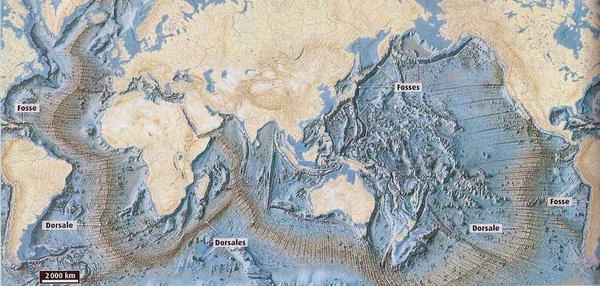
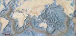
Geographical map of the ocean floor and plate boundaries. The seafloor relief creates ripples on the sea surface that correspond to a mini topography of the seafloor. An oceanic ridge corresponds to a bump of water on the surface, several meters high, and an oceanic trench corresponds to a hollow of water on the surface. Thus, high-precision altimetry satellites (within the order of cm) allow mapping of the underwater relief. The satellite method of seafloor mapping brings significant improvement as ≈80% of the ocean surface was not covered by shipboard bathymetric sounders. Bathymetry is the underwater equivalent of altimetry; it refers to the measurement of ocean depth.
Seafloor Relief
Seafloor relief is a complex and fascinating geomorphological feature that shapes the world's oceans. Understanding this relief is crucial for various scientific disciplines, including oceanography, geology, and marine biology.
The seafloor exhibits a variety of relief forms, ranging from vast abyssal plains to underwater mountain ranges, oceanic trenches, and mid-ocean ridges. These structures are the result of geological processes such as plate tectonics, volcanism, and erosion.
Measuring Underwater Relief with Satellites
Satellites play a crucial role in measuring seafloor relief through advanced techniques such as altimetry and bathymetry.
Altimetry uses radar-equipped satellites to measure the height of the sea surface. By measuring variations in sea surface height, scientists can deduce the characteristics of the underwater relief. Areas where the sea surface is higher generally indicate underwater mountains or ridges, while lower areas may indicate trenches or abyssal plains.
Bathymetry is the science of measuring ocean depths. Satellites use sensors to measure the reflection of radar waves on the ocean surface, allowing the mapping of depths and underwater reliefs. This technique is particularly useful for exploring areas that are difficult to access for research vessels.
Applications and Importance
Knowledge of seafloor relief is essential for several practical applications:
- Marine Navigation: Bathymetric maps help ships avoid underwater obstacles and navigate safely.
- Resource Exploration: Understanding underwater relief is crucial for exploring mineral and energy resources, such as polymetallic nodules and methane hydrates.
- Scientific Research: Bathymetric data is used to study geological processes, ocean circulation, and marine ecosystems.
- Risk Management: Knowledge of underwater relief helps predict and manage natural hazards such as tsunamis and underwater landslides.
Conclusion
Seafloor relief is a fascinating frontier of scientific exploration. Thanks to technological advancements, particularly the use of satellites for altimetry and bathymetry, we can better understand and map ocean depths. This knowledge is essential for navigation, resource exploration, scientific research, and natural risk management.
 From Black Basalt to Blue Oceans: Earth's Changing Palette
  Plate Tectonics: The Invisible Engine Moving the Continents
  The Number 360: The Mathematical Key to the Babylonian Sky
  Wet-Bulb Temperature: Humanity's Climate Time Bomb
  Why Doesn't Earth's Atmosphere Escape into Space?
  Origins of Earth: Magmatic Chaos and the Birth of the Solid World
  Earth's Atmosphere: The Invisible Shield Protecting Life
  The 5 Cosmic "End of the World" Scenarios (and Why They Won't Happen)
  Where does the water in the oceans come from? Three key stages
  From Carbon 14 to Uranium-Lead: The Science of Dating
  Major Natural Disasters: What Are the Most Likely Threats?
  The Boundary of Space: Where Does It Really Begin?
  536: The Year Without a Summer and the Beginning of the Late Antique Little Ice Age
  The leap second: scheduled end in 2035
  Planetary Alignments: A Fascinating but Relative Phenomenon
  All Deserts of the World
  Earth's Paleoclimates and Carbon Dioxide
  What is the effect of large lakes and water reservoirs on Earth's rotation?
  International Date Line
  Start Date of the Seasons: A Complex Celestial Mechanism
  Paleomagnetism: the magnetic memory of rocks
  3D Simulator: Revolutions of the Planets
  Geological Time and Mass Extinctions: From the Ordovician to the Cretaceous
  Earth History: Timeline Compressed into 24 Hours
  Earth's Water: An Extraterrestrial Origin?
  Reading the Sky: Understanding Declination and Right Ascension
  How is Earth's magnetic field born and why does it reverse?
  Earth's Magnetosphere: The Invisible Shield
 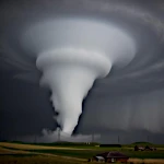 Fujita Scale: Classifying the Fury of Tornadoes
  Earth's Radioactivity: The Internal Energy of Our Planet
  The Deep Sea: Exploring the Deepest Ocean Trenches
 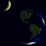 Why Are Days Getting Longer?
 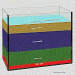 The Depths of the Earth: From the Lithosphere to the Core
  Earth's Movements: How Earth Traces Its Spiral Through the Universe?
 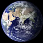 How much is the sea level rising?
 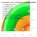 The Life of Earth: Structure and Layers of the Earth
  The Eccentricity of Earth's Orbit: An Ellipse That Changes Everything
  Little Ice Age: The History of a Natural Climatic Cooling
  The Quest for Time: How Ancient Civilizations Used Astronomy?
 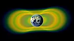 Van Allen Belt: A Rampart Against Cosmic Particles
 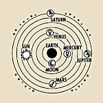 The Cosmos in Our Measure: When Man Invents the Universe
  What is the pendulum fixed relative to?
  Problem of longitude at sea
  World population, still gallopingin 2008
 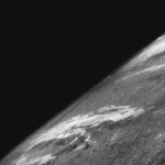 The Oldest Image of Earth from Space
 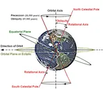 Earth's Obliquity and Variations in Its Axis of Rotation
  The Astronomical Unit Fixed: A Length, No Longer an Orbit
  Water: one molecule, three states on Earth
  Simulator, the round of near-Earth cruisers
  Satellites that measure underwater relief
  Hadean's Hell
  The First Free Flight of an Astronaut in Space
  The first measurement of the Earth-Sun distance
  La The Announced End of the World on December 21, 2012: A Millennial Prophecy
 The Equinoxes: An Astronomical Event
 Milankovitch Cycles: The Astronomical Rhythm of Earth's Climate
 Why Is Earth So Often Cloudy?