


Earth observation: behind the scenes of the Russian programme
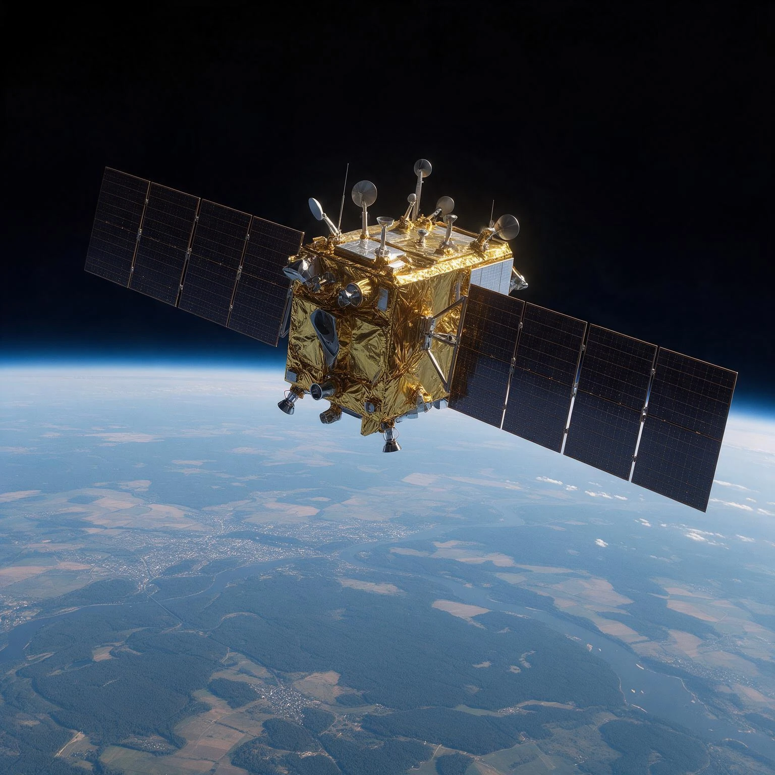
Visualisation of a Resurs-P satellite from the Russian Earth observation constellation flying over Siberia and the Arctic. The luminous streams symbolise the data transmitted to the Roscosmos geoportal, where they feed resource management, disaster monitoring and climate tracking.
Image source: astronoo.com (new window) : AI-generated image, public domain.
Summary
Russia has one of the oldest Earth observation programmes in the world, inherited from the Soviet era and now managed by Roscosmos. Unlike Copernicus, this programme has no single name and is not based on a fully open data policy. It is embodied in a heterogeneous fleet of satellites with evocative names: Resurs-P for high-resolution optical imaging, Kanopus-V for emergency monitoring, Kondor-FKA for radar, Arktika-M for the Arctic, Meteor-M and Elektro-L for meteorology. This article explores the behind-the-scenes workings of this ecosystem: its satellites, technical capabilities, geoportal, data policy and ambitions, at a time when Russia is seeking to rebuild an ambitious space constellation.
Does Russia have its own “Copernicus”?
A programme without a single name, but a tangible reality
The question is worth asking, because the answer is not simple. Copernicus is an integrated programme, with a single brand, a common data policy and centralised governance. Russia, by contrast, does not have a single programme bearing that name. Instead, it has an ecosystem of Earth observation coordinated by Roscosmos, distributed across several satellite series and several agencies.
This ecosystem is no less ambitious than Copernicus. It is simply organised according to a different logic: that of Soviet heritage, platform specialisation and a more controlled data policy. With its Resurs-P, Kanopus-V, Kondor-FKA and Arktika-M satellites, Russia has equipped itself with a complete observation capability, from optical to radar, from global to regional.
Also worth exploring
Continue your exploration of the Universe with these topics:
The Russian fleet: a heterogeneous constellation
Satellites with complementary capabilities
Russia has an orbital grouping for Earth observation that, according to official statements, numbered 19 satellites at the end of 2025[reference:0]. This fleet is presented as the only one in the world to be three-tiered, combining geostationary, highly elliptical and Sun-synchronous orbits[reference:1]. Each satellite series fulfils a specific mission.
The Resurs-P satellites are the high-resolution optical observation satellites. Resurs-P No. 4 and No. 5 are the most recent, with a resolution that can reach 70 cm according to some sources[reference:2]. They are intended for mapping, agriculture and natural resource monitoring. Their successor, Resurs-PM, is expected in 2026, with an even better resolution[reference:3].
The Kanopus-V satellites form a constellation of five satellites dedicated to emergency and environmental monitoring. They cover 93.5% of Russian territory and 90% of the planet, making them one of the pillars of national monitoring[reference:4]. Their resolution is 2.5 metres in panchromatic mode[reference:5].
The Kondor-FKA satellites are the fleet’s radar satellites. Two units were launched (2023 and 2024) and officially accepted into service in July 2025[reference:6]. They operate in S-band, which allows them to observe Earth day and night and in all weather conditions, with a resolution that can reach 1 metre in spot mode[reference:7][reference:8]. Their main mission is monitoring the Arctic and the Northern Sea Route[reference:9].
The Arktika-M satellites are highly elliptical satellites, unique in the world, designed to observe the Arctic continuously, a region inaccessible to classical geostationary satellites. The first was launched in 2021, the second in 2023, and two more are planned by 2031[reference:10]. They provide essential data for Arctic meteorology and climate[reference:11].
Finally, the Meteor-M (3 satellites) and Elektro-L (2 satellites) provide meteorological monitoring, respectively in polar and geostationary orbit[reference:12].
Table of the main Russian observation satellites
The table below summarises the main Earth observation satellite series in the Russian fleet, with their characteristics and applications.
| Series | Type | Resolution | Main application |
|---|---|---|---|
| Resurs-P | High-resolution optical | 0.7 m (pan) | Mapping, resources, agriculture |
| Kanopus-V | Medium-resolution optical | 2.5 m (pan) | Emergencies, environment, monitoring |
| Kondor-FKA | Radar (S-band) | 1 m (spot) | Arctic, all-weather, ice, ships |
| Arktika-M | Highly elliptical | Variable | Arctic, meteorology, climate |
| Meteor-M | Polar optical | Variable | Meteorology, climate |
| Elektro-L | Geostationary | Variable | Continuous meteorology |
| Obzor-R | Radar (under development) | Variable | All-weather observation |
Kondor-FKA: the radar watching over the Arctic
An all-weather capability for polar regions
The Kondor-FKA series is undoubtedly the most emblematic achievement of Russia’s new generation of satellites. Unlike optical satellites, which depend on lighting conditions and cloud cover, the Kondor-FKA satellites operate in S-band (frequency 3.1 to 3.3 GHz), allowing them to “see” through clouds and at night[reference:13].
This capability is crucial for the Arctic, where the polar night and extreme weather conditions make optical observation difficult. The Kondor-FKA satellites can therefore monitor sea ice, track ships using the Northern Sea Route, detect oil spills and map terrain[reference:14].
In July 2025, Roscosmos officially accepted the Kondor-FKA system into service after more than six months of testing[reference:15]. This acceptance marks the entry into operational service of Russia’s first radar constellation capable of observing Earth 24 hours a day and in all weather conditions[reference:16]. Two other satellites (Kondor-FKA No. 3 and No. 4) are under construction to strengthen the constellation[reference:17].
The Roscosmos geoportal: the gateway to data
A unified portal for observation data
Russia has developed its own Earth observation data access portal: the Roscosmos Geoportal (Geoportal Roscosmos). This portal, accessible at gptl.ru, combines a satellite image viewer and a search engine allowing users to browse Russia’s most complete catalogue of observation data[reference:18].
The geoportal provides access to a Federal Fund of Earth Observation Data (FFDD) containing data from Russian satellites. The data are available at different processing levels: level 1 corresponds to georeferenced and radiometrically corrected images, while level 2 corresponds to geocoded or orthorectified images, ready to be integrated into a geographic information system[reference:19].
A gradual but controlled opening
Unlike Copernicus, which practises full open data, Russia long maintained restricted access to its observation data. But the situation is changing. In December 2025, Roscosmos opened access to radar images from the Kondor-FKA satellites for registered users, including individuals and legal entities[reference:20][reference:21]. More than 700 information products derived from these data are now available[reference:22].
This opening remains framed: users must register, and certain types of data may be subject to restrictions. Russia does not yet practise total and free opening of its entire archives, unlike what the European Union does with Copernicus. But the trend is towards progressive liberalisation, driven by the political will to develop commercial and scientific uses.
Table of access arrangements for Russian data
The table below summarises the main access arrangements for Earth observation data in Russia, depending on sources and types of users.
| Source / Data type | Access | Platform |
|---|---|---|
| Meteorological data (Meteor-M, Elektro-L) | Open (via STAC API) | Roscosmos Geoportal |
| Radar data (Kondor-FKA) | On registration | Roscosmos Geoportal |
| Optical data (Resurs-P, Kanopus-V) | On request / commercial | Roscosmos Geoportal, operators |
| Derived products | Variable | Geoportal, partners |
Applications: from emergencies to the Arctic
A tool serving civil security
Russian observation data are used extensively for emergency management. The Ministry of Emergency Situations (MChS) is one of the main consumers of data from the Roscosmos fleet. In 2025, the MChS space monitoring system was mobilised in more than 150 incidents and emergency situations, and detected more than 74,000 thermal hotspots (of which more than 35,000 represented a real threat)[reference:23][reference:24].
Russia has also deployed an impressive receiving infrastructure: 15 ground stations, including in Cuba and Antarctica, capable of carrying out 748 reception sessions per day for a volume of up to 1 terabyte of data[reference:25]. This infrastructure allows rapid transmission of data to the authorities, with a delay that can reach 28 hours between the imaging request and data reception[reference:26].
The Arctic, a strategic priority
The Arctic is at the heart of Russia’s Earth observation strategy. The Arktika-M and Kondor-FKA satellites are specifically designed to monitor this region, which represents a major strategic challenge for Russia: the Northern Sea Route, energy resources and territorial sovereignty.
Data from the Arktika-M constellation have already made it possible to transmit more than 50 terabytes of information for climate forecasts in the Arctic region[reference:27]. These satellites are essential for understanding the rapid changes affecting the Arctic, where global warming is two to three times faster than elsewhere in the world.
Prospects and challenges
A constellation in full expansion
Russia has considerable ambitions for its Earth observation programme. According to official documents, the constellation is expected to grow significantly by 2030[reference:28]. The new national “Cosmos” project plans to launch 1,118 satellites over ten years, including 190 for Earth observation (80 funded by the federal budget and 110 by external sources)[reference:29].
Among the new satellites planned are Resurs-PM (first launch planned for 2026), Obzor-R (radar), and Kanopus-V-O for emergency monitoring[reference:30][reference:31]. The private sector is also expected to play a growing role, with constellations such as Zorkiy and GeoScan.
The challenges of sovereignty and openness
The Russian programme faces several challenges. The first is technological sovereignty: after the break in space cooperation with the West, Russia must rebuild its capacity to produce sensors and components, which had long depended on imports. The second is data policy: Russia must find a balance between strategic control of its data and the openness needed to develop commercial and scientific uses.
Finally, the Russian programme must face international competition: Copernicus, Landsat, CHEOS and commercial constellations offer increasingly abundant and increasingly accessible data. To remain competitive, Russia will not only have to maintain its fleet, but also improve access to its data and develop value-added services.
Key takeaways
Russia has an old, diversified and rapidly rebuilding Earth observation programme. With its Resurs-P, Kanopus-V, Kondor-FKA and Arktika-M satellites, it has equipped itself with a complete ecosystem capable of meeting national strategic needs, from Arctic monitoring to emergency management.
The comparison with Copernicus is revealing. Russia has not sought to reproduce the European model of a single, centralised programme. Instead, it has built a decentralised ecosystem, coordinated by Roscosmos, with a data policy that remains more controlled than that of the European Union, but is gradually opening up. At a time when Russia is investing massively in its space programme, its Earth observation ecosystem could well enter a new phase of expansion in the years to come.
References
- eoPortal - Resurs-P (Resurs-Prospective), Earth observation constellation (new window)
- WMO (WMO OSCAR) - Resurs-P satellite programme (new window)
- Glavkosmos - Earth observation data and solutions (Resurs-P, Kanopus-V) (new window)
- Interfax - Roscosmos announces five remote sensing satellites including Resurs-P5 and Kondor-FKA (new window)
FAQ: Russia and Earth observation
What is the Russian equivalent of Copernicus?
There is no single programme bearing that name. The functional equivalent is the Roscosmos Earth observation ecosystem, which relies on a fleet of satellites (Resurs-P, Kanopus-V, Kondor-FKA, Arktika-M, Meteor-M, Elektro-L) and on the Roscosmos Geoportal.
How many observation satellites does Russia have?
According to official statements, the Earth observation fleet numbered 19 satellites at the end of 2025[reference:32]. This number is expected to increase considerably in the years to come, with a target of 80 new observation satellites by 2036[reference:33].
What is Kondor-FKA?
Kondor-FKA is a Russian radar satellite operating in S-band. It is capable of observing Earth day and night and in all weather conditions, with a resolution that can reach 1 metre. It is particularly suited to monitoring the Arctic and the Northern Sea Route[reference:34].
Are Russian observation data free?
Not entirely. Unlike Copernicus, Russia does not practise full open data. Some meteorological data are open, and access to Kondor-FKA radar images was opened on registration in 2025. But many data remain subject to restrictions or commercial conditions[reference:35].
What is the Roscosmos Geoportal?
The Roscosmos Geoportal (gptl.ru) is the unified access portal for Earth observation data in Russia. It allows users to search, visualise and order data from Russian satellites, and provides access to the Federal Earth Observation Data Fund[reference:36].
What is special about the Arktika-M satellites?
The Arktika-M satellites are highly elliptical satellites, a configuration unique in the world that allows them to observe the Arctic continuously, a region inaccessible to classical geostationary satellites. They provide essential data for Arctic meteorology and climate[reference:37].
Does Russia cooperate with other countries on Earth observation?
Yes, but more limitedly than in the past. Russia provides data to other countries, particularly for disaster management, and participates in international programmes. But space cooperation with the West has greatly reduced since 2022[reference:38].
 Earth observation: behind the scenes of the Russian programme
 ISRO: behind the scenes of India's Earth observation programme
 Landsat, USGEO, ESO: the American Earth observation ecosystem
 CHEOS: behind the scenes of the Chinese Earth observation system
 Copernicus: behind the scenes of the largest Earth observation programme
 How to Spot Starlink Satellite Trains in the Sky?
 AI, the Astronomer's New Eye: From Analysis to Cosmic Prediction
 What
the First Images from Perseverance Show Us: The Surface of Mars, As If We Were There
 GRAIL
Twin Probes: Mapping the Moon's Hidden Interior
 Earth Under Surveillance: Observation Satellites
 March 2010: The
Ring of Fire Captured by the SDO Observatory
 Positions of Space Probes in 2025
 Giants of Observation: The Largest Ground-Based Telescopes
 Low
Earth Orbits and their uses
 Pioneer, first message to extraterrestrials!
 Infrared images: how to make them visible?
 Sputnik 1
and 2: The Dawn of the Space Age
 Lagrange Points: Gravitational Gateways of the Solar System
 Mars Reconnaissance
Orbiter: The Lynx Eye Revealing Martian Secrets
 Kepler:
4,000 Worlds and More, A New Map of the Sky
 Cheops
Space Telescope: A New Vision on Exoplanets
 The world of Planck
 Rosetta
Space Probe: Comet Churyumov-Gerasimenko
 The
Hubble Space Telescope: Three Decades of Revelations
 Première photo du télescope Hubble
 Satellites that measure underwater relief
 MESSENGER:
The First Probe to Visit the Mysterious Planet
 How GPS Locates
Your Position at Any Time?
 The ISS and Beyond? Towards the End of a Space Chapter
 Space Telescopes: Humanity's Eye Beyond the Atmosphere
 Space
Probes: Interplanetary Travelers and Beyond
 The GAIA
satellite maps the Milky Way
 How
to calculate the synchronous orbit?
 E-ELT: The World's Largest Optical Telescope
 Mercury probes
 Space
debris: the nightmare of operational satellites
 Aquarius:
A Mission to Map Ocean Salinity
 JWST:
An Unprecedented Look at the First Lights of the Universe
 METEOSAT: A Key Satellite for Climate Monitoring
 Curiosity, the first shovel, sample of Martian soil
 From
Mariner to Perseverance: Successes and Failures of Mars Probes
 Where is the geostationary orbit?
 MOM, the
technological demonstration
 Venus under surveillance: an overview of space probes
 What Is an Astronomical
Interferometer?
 The Philae Robot and the Rosetta Comet
 Mauna
Kea Under the Stars: The CFHT Telescope in Pursuit of the Universe's Mysteries