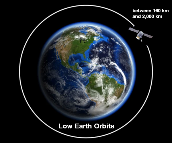
Image description: Low orbits are situated between 160 km and 2,000 km.
Low orbits, commonly referred to as LEO (Low Earth Orbit), play a crucial role in space exploration and space infrastructure. They are located at altitudes between 160 km and 2,000 km above the Earth's surface.
This orbital domain is the closest to the planet, and below this limit (160 km), several physical factors prevent a satellite from maintaining a stable orbit. Indeed, atmospheric drag becomes so strong that the satellite's kinetic energy is quickly dissipated. This drag causes a gradual degradation of the orbit, causing the satellite to lose altitude and descend into denser atmospheric layers. This ultimately leads to disintegration by thermal friction or atmospheric re-entry.
Low orbits, between 160 and 2,000 km, allow objects in LEO to complete a full revolution around the Earth in 90 to 120 minutes, with an orbital velocity of about 7.8 km/s (approximately 28,000 km/h).
Due to their proximity, satellites in low orbit enable repeated observation of the Earth's surface.
In LEO, a satellite can only observe a small portion of the Earth's surface at any given time, requiring multiple satellites for continuous global coverage.
In 2020, according to the Union of Concerned Scientists (UCS), there were approximately 1,918 satellites in low orbit. Since then, this number has significantly increased, largely thanks to mega-constellations of satellites like Starlink (12,000 in phase 1).
Low orbits offer several advantages due to their proximity to Earth, making them suitable for various applications in technology, science, and industry.
Constellations of low-orbit satellites are increasingly used to provide telecommunications and high-speed Internet services. Low orbits reduce latency compared to geostationary satellites (36,000 km), which is critical for real-time communications.
- Examples: Starlink, OneWeb, Telesat, etc.
Low-orbit satellites are commonly used for Earth monitoring, mapping, meteorology, and environmental observation. Due to their proximity, they can obtain high-resolution images of the Earth's surface (climate change, agricultural monitoring, disaster management, etc.).
- Examples: Sentinel (ESA), Landsat (NASA), CloudSat (NASA), SMAP (NASA), etc.
Low orbits are used for military and intelligence satellites, which provide crucial information on military movements, surveillance activities, and border control. Their proximity allows for frequent revisions and enhanced surveillance capabilities.
- Examples: Corona (United States), Zenit (Russia), etc.
Many scientific instruments and space observatories are placed in low orbit to observe both Earth and space. Low orbits also enable human missions in space.
- Examples: the International Space Station (ISS), space telescopes (Hubble, JWST), etc.
The increasing congestion of low orbits with space debris poses challenges for satellite safety and missions. Satellites are used to capture or redirect debris into Earth's atmosphere for destruction.
- Example: RemoveDEBRIS (ESA), ClearSpace-1 (ESA), etc.
Space tourism uses low orbits for short flights that allow the experience of microgravity.
- Examples: SpaceX Dragon, Blue Origin.