


ISRO: behind the scenes of India's Earth observation programme
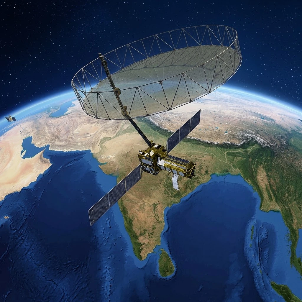
Visualisation of a satellite from the IRS (Indian Remote Sensing) series flying over India, capturing images for resource management, agriculture and disaster prevention. The light streams symbolise the massive data flows broadcast via the Bhoonidhi and Bhuvan portals.
Image source: astronoo.com (new window) : AI-generated image, public domain.
Abstract
In just a few decades, India has equipped itself with one of the most comprehensive Earth observation programmes in the world. Led by ISRO (Indian Space Research Organisation), it is based on the historic series of IRS (Indian Remote Sensing) satellites, deployed since 1988, and on new-generation missions such as NISAR, developed jointly with NASA. Unlike Copernicus, this programme has no single name, but it is united by an increasingly open data policy, embodied by the Bhoonidhi and Bhuvan portals. This article explores the behind-the-scenes of this ecosystem: its satellites, its technical capabilities, its data policy and its international ambitions, at a time when India is seeking to assert its space sovereignty.
Does India have its own "Copernicus"?
An old programme, a unique identity
The answer is yes, but with nuances. India has an ambitious and long-standing Earth observation programme, managed by the Department of Space (DOS) and implemented by ISRO[reference:0]. This programme is not structured like Copernicus, with a single brand and centralised governance at European level. It relies on a fleet of satellites with varied names (IRS, Cartosat, Resourcesat, Oceansat, Risat, EOS) and on a set of dissemination platforms.
Yet the comparison with Copernicus is relevant on more than one count. Like the European programme, the Indian programme aims to provide data for resource management, environmental monitoring and disaster response. And like Copernicus, it recently crossed a decisive threshold in terms of data openness, with the adoption of the Indian Space Policy in 2023.
Also worth exploring
Continue your exploration of the Universe with these topics:
The IRS fleet: a history spanning more than thirty years
From pioneering beginnings to maturity
India's satellite remote sensing programme began with the launch of IRS-1A in 1988. Since then, ISRO has deployed a succession of satellite generations, each bringing improvements in resolution, spectral coverage or revisit frequency. The Resourcesat, Cartosat, Oceansat and Risat series have specialised in complementary fields: land resources, high-resolution mapping, oceans and radar.
This continuity has enabled India to build an exceptional data archive, dating back to 1988. This historical depth is a major asset for long-term change studies, comparable to that of Landsat for the United States.
Table of the main IRS satellite families
The table below summarises the main ISRO Earth observation satellite families, with their characteristics and applications.
| Family | Examples | Sensor type | Main application |
|---|---|---|---|
| IRS | IRS-1A to 1D, Resourcesat | Multispectral optical | Land resources, agriculture, land use |
| Cartosat | Cartosat-1, -2, -3 | High-resolution optical | Mapping, urban planning, defence |
| Oceansat | Oceansat-2, EOS-06 | Oceanographic optical | Water colour, fisheries, climate |
| Risat | RISAT-1, -2 | Radar (SAR) | All-weather monitoring, agriculture, disasters |
| EOS | EOS-04, EOS-05 | Optical, radar, geostationary | Continuous observation, disaster management |
| NISAR | NISAR (NASA-ISRO) | Dual-frequency radar (L and S) | Land surfaces, ice, deformation |
NISAR: a flagship cooperation mission
The world's first dual-frequency radar
The NISAR mission (NASA-ISRO Synthetic Aperture Radar) is undoubtedly the most emblematic achievement of Indo-American space cooperation. Launched on 30 July 2025 aboard the GSLV-F16 launcher, it is described as the world's first space radar mission to carry two instruments operating at two different frequencies: an L-band radar developed by NASA and an S-band radar built by ISRO[reference:1][reference:2].
Following the successful deployment of its 12-metre reflector antenna in August 2025, NISAR began its science phase. In February 2026, more than 100,000 level 1 to 3 data products were made available, and the mission celebrated its first anniversary in orbit in August 2026[reference:3][reference:4]. NISAR data are integrated into the Bhoonidhi portal and are expected to revolutionise the observation of ground deformation, glaciers and ecosystems.
Data policy: a gradual opening
From restricted access to open data
For a long time, access to Indian satellite data was subject to restrictions. But India made a major shift with the Indian Space Policy of 2023. This policy introduced the "free and open" dissemination of IRS data: all archives since 1988 and current data at resolutions of 5 metres and coarser are now freely accessible to all users, via the Bhoonidhi portal[reference:5][reference:6].
For data at resolutions finer than 5 metres, the regime is differentiated: they are free for government entities that declare them, but chargeable for non-governmental entities, via NSIL (NewSpace India Limited), ISRO's commercial arm[reference:7]. This hybrid approach reflects India's desire to reconcile openness and sovereignty.
Table of data access arrangements
The table below summarises the rules for accessing Indian Earth observation data according to their resolution and the type of user.
| Data type | Resolution | Access | Platform |
|---|---|---|---|
| Open data | 5 m and coarser | Free and open to all | Bhoonidhi |
| Government data | Finer than 5 m | Free on declaration | Bhoonidhi |
| Commercial data | Finer than 5 m | Chargeable (NSIL) | Bhoonidhi (via NSIL) |
| Derived products | Variable | Transparent pricing | NRSC / Bhoonidhi |
Bhoonidhi and Bhuvan: the ecosystem portals
Bhoonidhi, the data hub
Bhoonidhi is ISRO's unified portal for accessing Earth observation data. It allows users to search, visualise, analyse and download data from Indian satellites as well as from partner foreign missions such as Landsat-8/9, Sentinel-1/2 and NovaSAR[reference:8][reference:9]. This integration of international data is a notable feature that enhances the portal's appeal for Indian users.
The portal provides access to an archive covering more than 30 years of data from dozens of satellites[reference:10]. It is the cornerstone of India's open data policy.
Bhuvan, the geospatial platform
Bhuvan is ISRO's geospatial platform, launched in 2009. It allows users to visualise and download geospatial data, produce thematic maps and carry out spatial analyses. Bhuvan is used for applications as varied as urban planning, disaster management, agriculture and water resource monitoring[reference:11].
Unlike Bhoonidhi, which focuses on raw satellite data, Bhuvan positions itself as a geospatial services platform, with analysis tools and ready-to-use thematic products.
Recent launches and the future of the programme
EOS-05 and geostationary observation
On 4 September 2026, ISRO successfully launched EOS-05 aboard the GSLV-F17 launcher. This 2,367-kilogram satellite is India's first imaging satellite in geosynchronous orbit, marking an important milestone in India's observation capabilities[reference:12]. It will provide real-time imagery for agriculture, disaster management and other strategic applications[reference:13].
This launch follows several missions, some of which met with failure, but it confirms India's determination to strengthen its Earth observation constellation.
Future missions and international cooperation
India is also preparing several cooperation missions. The Trishna mission, developed with the French CNES, is a thermal infrared observation mission under development[reference:14]. ISRO also plans joint satellites with Bhutan, Mauritius and Nepal[reference:15]. These partnerships illustrate India's desire to play a leading regional role in the field of Earth observation.
Key takeaways
India has an old, diversified and increasingly open Earth observation programme. With its IRS satellites, its flagship missions such as NISAR and its Bhoonidhi and Bhuvan portals, it has equipped itself with a complete ecosystem, suited to its national needs and international ambitions.
The comparison with Copernicus is illuminating. India has not sought to reproduce the European model of a single, centralised programme. Instead, it has built a decentralised ecosystem, coordinated by ISRO, with a data policy that combines openness and strategic control. This singular approach, driven by growing international cooperation, could well make India a leading player in Earth observation in the 21st century.
References
FAQ: India and Earth observation
What is India's equivalent of Copernicus?
There is no single programme bearing that name. The functional equivalent is ISRO's Earth observation programme, which relies on the IRS (Indian Remote Sensing) satellite fleet and on the Bhoonidhi and Bhuvan portals. This programme is managed by the Department of Space and implemented by ISRO.
Is Indian satellite data free?
Since the Indian Space Policy of 2023, data at resolutions of 5 metres and coarser are free and open to all via the Bhoonidhi portal. Finer data are free for government entities on declaration, and chargeable for non-governmental users.
What is Bhoonidhi?
Bhoonidhi is ISRO's unified portal for accessing Earth observation data. It allows users to search, visualise and download data from Indian satellites (IRS, Cartosat, Oceansat, etc.) and from partner international missions.
What is the NISAR mission?
NISAR (NASA-ISRO Synthetic Aperture Radar) is a joint NASA-ISRO mission, launched on 30 July 2025. It is the world's first satellite to carry two radars operating at different frequencies (L-band and S-band). It provides essential data for the study of land surfaces, ice and ground deformation.
What is the difference between Bhoonidhi and Bhuvan?
Bhoonidhi is a portal for raw satellite data, allowing the search and download of products. Bhuvan is a geospatial services platform, offering visualisation tools, analysis tools and ready-to-use thematic products.
Does India cooperate with Copernicus?
Yes. In 2018, India and the European Union signed a cooperation agreement for the exchange of data between Copernicus and Indian satellites. This agreement provides for free and open access to Sentinel data for India, and the integration of ISRO data into the Copernicus hub[reference:16].
What are the recent Indian Earth observation satellite launches?
Recent launches include NISAR (July 2025) and EOS-05 (September 2026), India's first imaging satellite in geosynchronous orbit. These missions strengthen India's observation capabilities.
 Earth observation: behind the scenes of the Russian programme
 ISRO: behind the scenes of India's Earth observation programme
 Landsat, USGEO, ESO: the American Earth observation ecosystem
 CHEOS: behind the scenes of the Chinese Earth observation system
 Copernicus: behind the scenes of the largest Earth observation programme
 How to Spot Starlink Satellite Trains in the Sky?
 AI, the Astronomer's New Eye: From Analysis to Cosmic Prediction
 What
the First Images from Perseverance Show Us: The Surface of Mars, As If We Were There
 GRAIL
Twin Probes: Mapping the Moon's Hidden Interior
 Earth Under Surveillance: Observation Satellites
 March 2010: The
Ring of Fire Captured by the SDO Observatory
 Positions of Space Probes in 2025
 Giants of Observation: The Largest Ground-Based Telescopes
 Low
Earth Orbits and their uses
 Pioneer, first message to extraterrestrials!
 Infrared images: how to make them visible?
 Sputnik 1
and 2: The Dawn of the Space Age
 Lagrange Points: Gravitational Gateways of the Solar System
 Mars Reconnaissance
Orbiter: The Lynx Eye Revealing Martian Secrets
 Kepler:
4,000 Worlds and More, A New Map of the Sky
 Cheops
Space Telescope: A New Vision on Exoplanets
 The world of Planck
 Rosetta
Space Probe: Comet Churyumov-Gerasimenko
 The
Hubble Space Telescope: Three Decades of Revelations
 Première photo du télescope Hubble
 Satellites that measure underwater relief
 MESSENGER:
The First Probe to Visit the Mysterious Planet
 How GPS Locates
Your Position at Any Time?
 The ISS and Beyond? Towards the End of a Space Chapter
 Space Telescopes: Humanity's Eye Beyond the Atmosphere
 Space
Probes: Interplanetary Travelers and Beyond
 The GAIA
satellite maps the Milky Way
 How
to calculate the synchronous orbit?
 E-ELT: The World's Largest Optical Telescope
 Mercury probes
 Space
debris: the nightmare of operational satellites
 Aquarius:
A Mission to Map Ocean Salinity
 JWST:
An Unprecedented Look at the First Lights of the Universe
 METEOSAT: A Key Satellite for Climate Monitoring
 Curiosity, the first shovel, sample of Martian soil
 From
Mariner to Perseverance: Successes and Failures of Mars Probes
 Where is the geostationary orbit?
 MOM, the
technological demonstration
 Venus under surveillance: an overview of space probes
 What Is an Astronomical
Interferometer?
 The Philae Robot and the Rosetta Comet
 Mauna
Kea Under the Stars: The CFHT Telescope in Pursuit of the Universe's Mysteries