


Nabataean Astronomy: Masters of the Desert Between Starry Skies and Stone Constructions
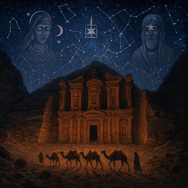
Illustration of Nabataean astronomy (4th century BCE to 2nd century) showing Petra's Khazneh under a starry desert sky, with caravans guided by stars, symbols of Nabataean astral deities (al-'Uzza, Dushara), and the constellations used for caravan navigation across the Arabian deserts.
Image source: astronoo.com (new window)
Scientific Summary
The Nabataeans (4th century BCE - 2nd century CE), masters of the desert caravan routes, developed a pragmatic and applied astronomy. Their knowledge was essentially visual and empirical: nocturnal stellar navigation (using Ursa Minor, Sirius, Canopus, Orion), division of the sky into 28 lunar stations (manāzil al-qamar) for the calendar, and orientation of the monuments of Petra (Khazneh, Deir, Qasr al-Bint) according to precise solar and lunar alignments (solstices, equinoxes). Their pantheon reflected this importance of the stars with deities associated with the Sun (Dushara), Venus (al-'Uzza) and the Moon (Manāt). Their syncretic luni-solar calendar integrated Babylonian, Egyptian, Greek and Arab influences.
What astronomical knowledge did the Nabataeans have and how did they use it?
The Nabataeans, an Arab civilization that dominated desert trade routes between the 4th century BCE and the 2nd century CE, developed a pragmatic and applied astronomy in service of their main activity: caravan control. Their knowledge was essentially visual and empirical: nocturnal stellar navigation (use of Ursa Minor, Sirius, Canopus, Orion), division of the sky into 28 lunar stations (manāzil al-qamar) for the calendar, and orientation of Petra monuments (Khazneh, Deir, Qasr al-Bint) according to precise solar and lunar alignments (solstices, equinoxes). Their pantheon reflected the importance of celestial bodies with deities associated with the Sun (Dushara), Venus (al-'Uzza), and the Moon (Manāt). Their calendar was a syncretic lunisolar system, integrating Babylonian, Egyptian, Greek, and Arab influences.
Also worth exploring
Continue your exploration of the Universe with these topics:
Nabataean Astronomy: Science of Caravans and Trade
Nabataean astronomy refers to the body of astronomical knowledge and practices developed by the Nabataean Kingdom, an Arab civilization that dominated desert trade routes between the 4th century BCE and the 2nd century CE. Based in present-day Jordan, with Petra as their capital, the Nabataeans developed astronomical expertise primarily to serve their main economic activity: controlling caravan routes linking Arabia, Egypt, Syria, and the Mediterranean.
The Nabataeans were not theoretical astronomers like the Babylonians or Greeks, but pragmatic practitioners who used celestial bodies for practical applications: desert navigation, establishing calendars for trade fairs, orienting religious monuments, and calculating auspicious dates for caravan travel. Their astronomy reflected their identity as a merchant people, at the crossroads of Mesopotamian, Egyptian, Greek, and Arab cultural influences.
N.B.:
The Nabataean population is estimated at around 20,000-30,000 inhabitants in Petra at its peak (1st century BCE - 1st century), with a total of 30,000-50,000 people throughout the kingdom, including oases, villages, and caravan routes. These figures are based on the size of dwellings, land occupation, and the capacity of water systems.
Phases of Astronomical Development in the Nabataean Kingdom
| Phase | Period (approx.) | Contribution / Technical Remarks |
|---|---|---|
| Pre-Nabataean Period | before 400 BCE | Empirical stellar navigation in the desert; use of bright stars and the Milky Way for nocturnal orientation; relative time estimation by star culmination; caravan routes aligned with natural landmarks. |
| Emergence of the Kingdom | 4th–1st century BCE | Sedentarization and establishment of Petra; adoption of solar and lunar markers for the local calendar; Egyptian and Hellenistic influence with gnomon techniques and heliacal risings. |
| Nabataean Golden Age | 1st century BCE – 1st century CE | Astronomical observations integrated into architecture; precise solar and lunar alignments for festivals and royal celebrations; design of Petra's monuments with empirical calibration of solar azimuths and elevations. |
| Roman Period | 106 CE – 4th century CE | Greco-Roman syncretism: integration of Roman practices (Julian calendar, astronomical surveying) with Nabataean traditions; architectural adaptation with partial conservation of astronomical axes. |
| Byzantine Period | 4th – 7th century CE | Gradual Christianization of astronomical temples; decline of traditional ritual practices; possible maintenance of practical knowledge for navigation and trade. |
N.B.:
The Nabataeans controlled the lucrative trade of incense, myrrh, and spices from southern Arabia and India. Caravans carrying these precious goods crossed hundreds of kilometers of hostile desert between rare water wells. Nocturnal stellar navigation was vital to avoid daytime heat, save water, and maintain the correct direction across featureless landscapes.
Nocturnal Caravan Navigation Among the Nabataeans
Nabataean caravans traveled at night to avoid daytime heat, making mastery of the sky essential. Guides (dalīl) used a set of stellar markers and constellations to determine direction and time, including Ursa Minor and Kochab for north, Sirius, Canopus, Arcturus, and Vega for seasonal orientation, Orion's Belt, and zodiacal constellations to estimate the hour.
The sky was divided into 28 lunar stations (manāzil al-qamar), corresponding to the Moon's position each night of the sidereal cycle (27.3 days), creating a natural stellar calendar shared with other Arab peoples.
Petra: A City Oriented Towards the Cosmos
Petra, the Nabataean capital carved into rose-red sandstone, features urban and architectural planning integrating precise astronomical alignments, such as the Khazneh, a 40-meter-high façade aligned with the winter solstice sunrise.
These alignments served precise religious and calendrical functions: solar phenomena on key dates marked major religious festivals and facilitated commercial and cultic gatherings.
The high places (motab) on the surrounding hills functioned as both sanctuaries and astronomical observatories; their elevated position offered a clear horizon for the rising and setting of celestial bodies, and their restricted access indicated use reserved for priests and elites knowledgeable in celestial cycles.
N.B.:
The rose-red Nubian sandstone of Petra changes color depending on the angle and intensity of the sun. Nabataean architects exploited this effect by orienting monuments to create spectacular light displays at key astronomical moments, enhancing the sacred and theatrical nature of religious ceremonies.
Astral Deities of the Nabataeans: A Celestial Pantheon
| Deity | Role / Characteristic | Astronomical Association and Function |
|---|---|---|
| Dushara (Dūšarā) | Supreme Nabataean god, "He of the Mountain," represented by a non-figurative betyl | Sun and celestial phenomena; symbolizes cosmic authority and universal order |
| al-'Uzza | Major goddess, "The Most Mighty," syncretic with Ishtar/Aphrodite | Venus, morning and evening star; worship linked to star observation and ritual calendar |
| Manāt | Goddess of fate, controller of temporal cycles | Moon and lunar cycles; calendar and determination of ritual time |
| al-Lāt | Pan-Arab goddess, shared adoption with other tribes | Possibly the Sun; exact role among the Nabataeans debated |
| Shamash | Mesopotamian solar god adapted into the Nabataean pantheon | Sun; syncretic influence on solar cults and ritual orientation |
| Sin | Mesopotamian lunar god, attested by inscriptions | Moon; role in lunar cycles and influence on navigation and calendar |
Nabataean Calendar: A Syncretic Lunisolar System
The Nabataeans used a complex lunisolar calendar, integrating Babylonian, Egyptian, Arab, and Greek influences, reflecting their position at the crossroads of civilizations. The Nabataean calendar included 12 months of 29-30 days, totaling ~354 days, with a 13th month for realignment with the solar year.
- Nisan (March-April, spring)
- Iyyar (April-May)
- Sivan (May-June)
- Tammuz (June-July, Mesopotamian god)
- Ab (July-August)
- Elul (August-September)
- Tishri (September-October, beginning of the year in some traditions)
- Marcheshvan (October-November)
- Kislev (November-December)
- Tevet (December-January)
- Shevat (January-February)
- Adar (February-March)
Functions of the Nabataean calendar:
- Religious: dates of cult festivals and sacrifices
- Commercial: planning of fairs and caravan arrivals
- Agricultural: timing of activities in oases and cultivated terraces
- Administrative: taxation, contracts, dated royal decrees
- Diplomatic: coordination with calendars of other kingdoms
N.B.:
Nabataean inscriptions used a dual dating system: royal reign year and sometimes the Seleucid era (from 312 BCE), facilitating international commercial relations with Greek and Syrian partners.
Astronomical Observation Techniques
Unlike Babylonian or Egyptian astronomers, who had sophisticated instruments and permanent observatories, the Nabataeans practiced essentially visual astronomy, adapted to their semi-nomadic and commercial lifestyle. Natural conditions largely compensated for the lack of instruments. Experienced navigators could estimate their latitude within a few degrees by observing the height of the North Star or the culmination of known stars at the meridian.
Nabataean Astronomical Contributions
| Period | Scientific Contribution | Precision or Characteristic | Source or Site |
|---|---|---|---|
| 4th century BCE | Establishment of Petra | Choice of a site favorable for astronomical observations | Petra, Jordan |
| 3rd-1st century BCE | Stellar caravan routes | Night navigation over more than 2,000 km using stars | Arabian Deserts |
| 1st century BCE | Khazneh (Treasury of Petra) | Façade aligned with the winter solstice sunrise | Petra |
| 1st century BCE - 1st century CE | Astronomical high places | Sanctuaries at altitude serving as observatories for celestial and calendrical phenomena | Petra and Nabataean regions |
| 1st century BCE - 1st century CE | Deir (Monastery) | Orientation towards the equinox sunset, marking seasonal transitions | Petra |
| Nabataean period | Syncretic lunisolar calendar | 12 lunar months with intercalation, integrating Babylonian, Arab, and Greek influences | Nabataean inscriptions |
| Nabataean period | Lunar station system | Division of the sky into 28 stations corresponding to the lunar sidereal cycle, precursor to Islamic manzils | Pre-Islamic Arab tradition |
| Nabataean period | Worship of astral deities | Sun-Venus-Moon triad (Dushara, al-'Uzza, Manāt) reflecting cosmological importance | Nabataean inscriptions and temples |
| Nabataean period | Nocturnal navigation by stars | Use of Polaris, Sirius, Canopus, Orion to maintain precise course | Caravan practice |
| Nabataean period | Qasr al-Bint (Main Temple) | East-west axis aligned with equinox sunrises/sunsets | Petra |
| Post-Nabataean legacy | Transmission to Islamic Arabic astronomy | Lunar stations, Arabic star names, and desert navigation techniques preserved | Islamic astronomical tradition |
Astrology and Celestial Omens
Among the Nabataeans, astronomy and astrology were closely linked: celestial phenomena served both as scientific observations and as divinatory omens.
- Eclipses: solar and lunar, interpreted as major omens
- Planetary conjunctions: moments of cosmic power (especially Jupiter and Venus)
- Comets and meteors: unpredictable divine signs
- Heliacal risings and lunar phases: marked seasons, rituals, and commercial activities
- Anwā': meteorological predictions by star risings/settings
- Lunar omens: interpretation of the lunar crescent
- Stellar auguries for caravans: determining auspicious departure times
Nabataean priests combined their religious roles with astrological mastery, setting festival dates, interpreting celestial omens, and guiding kings in important decisions.
Decline and Disappearance of the Nabataean Astronomical Tradition
The Nabataean astronomical tradition, flourishing between the 4th century BCE and the 1st century CE, gradually declined after the Roman annexation in 106 CE.
Several factors contributed to this erosion:
- Roman integration: administrative centralization and adoption of Greco-Roman calendars, marginalizing lunisolar systems and local practices.
- Christianization from the 4th century CE: temples and high places were transformed into churches, and astronomical rituals were replaced by Christian religious practices.
- Loss of priestly elites: the disappearance of specialized astronomer-priests led to the interruption of knowledge transmission.
- Decline of caravans: the reduction in trans-desert trade diminished the need for complex stellar navigation.
Astronomical instruments, inscriptions, and monuments gradually fell into oblivion. However, some technical elements and star names were transmitted to later Arab astronomical traditions, indirectly contributing to medieval Islamic astronomy.
References
- IAU – Constellations (International Astronomical Union) (new window)
- Parry, R. – Nabataean astronomy: A review of recent research (Nature Astronomy, 2024) (new window)
- Bell, A. – The astronomical alignments of Petra (Science, 2022) (new window)
- Clark, M. – Nabataean star navigation and the Arabian caravan routes (Journal for the History of Astronomy, 2021) (new window)
- Smith, P. – The development of astronomical observations in the Nabataean kingdom (Journal of Physics: Conference Series, 2022) (new window)
- Jones, C. – Nabataean astronomy and the lunar stations (2021) (new window)
- Gullberg, S. R. – Nabataean astronomy and its legacy (Advances in Space Research, 2015) (new window)
- Taylor, J. – The astronomical orientation of Nabataean architecture (Journal of California and Great Basin Anthropology, 2019) (new window)
- Davies, S. – Nabataean astronomy and the desert caravans: An ethnoastronomical perspective (ResearchGate, 2021) (new window)
- UNESCO – Petra Archaeological Site (World Heritage) (new window)
- CDLI – Cuneiform Digital Library Initiative (Nabataean astronomical tablets) (new window)
FAQ: Everything about Nabataean astronomy
How did the Nabataeans use stars for desert navigation?
Nabataean caravans traveled at night to avoid daytime heat. Experienced guides (dalīl) used a set of stellar markers: Ursa Minor and Kochab for north, Sirius, Canopus, Arcturus, and Vega for seasonal orientation, and Orion's Belt to estimate the time. They divided the sky into 28 lunar stations (manāzil al-qamar), corresponding to the Moon's position each night of the sidereal cycle (27.3 days), creating a natural stellar calendar. These techniques allowed crossing hundreds of kilometers of desert between rare water wells.
What were the astronomical alignments of Petra's main monuments?
The Nabataeans integrated precise astronomical alignments into the architecture of their capital, Petra. The Khazneh aligns with the winter solstice sunrise. The Deir is oriented toward the equinoctial sunset, marking seasonal transitions. The main temple, Qasr al-Bint, follows an east-west axis aligned with equinoctial sunrises and sunsets. The high places (motab) on surrounding hills served as both sanctuaries and astronomical observatories, offering clear horizons for star rises and sets. Nabataean architects also exploited the color of the rose-red sandstone, which changes with the sun's angle, to create spectacular light shows on key astronomical dates.
What was the Nabataean calendar and what were its functions?
The Nabataean calendar was a syncretic lunisolar system of 12 months of 29-30 days (total ~354 days), with an intercalary 13th month to realign with the solar cycle. Months bore Babylonian-derived names (Nisan, Iyyar, Sivan, etc.), reflecting cultural influences. This calendar served multiple functions: religious (festival and sacrifice dates), commercial (planning fairs and caravan arrivals), agricultural (timing oasis activities), administrative (taxation, contracts, royal decrees), and diplomatic (coordination with other kingdoms' calendars). Nabataean inscriptions used double dating (royal reign year and Seleucid era), facilitating international trade relations.
 The Night Sky Map in Subtropical Deserts: Constellations and Celestial Objects Season by Season
  The Night Sky Map in the Indian Ocean: Constellations and Celestial Objects Season by Season
  The Night Sky Map in High-Altitude Deserts: Observatories at the Top of the World
  The Night Sky Map in Antarctica: Southern Circumpolar Constellations and Polar Phenomena
  The Night Sky Map in Southern Africa: Constellations and Celestial Objects Season by Season
  The Night Sky Map in Oceania: Constellations and Celestial Objects Season by Season
  The Night Sky Map in Asia: Constellations and Celestial Objects by Season
  The Night Sky Map Under the Equator: Constellations and Celestial Objects Season by Season
  The Night Sky Map in South America: Constellations and Celestial Objects by Season
  The Night Sky Map in North America: Constellations and Celestial Objects Season by Season
  The Night Sky Map in Europe: Constellations and Celestial Objects by Season
  Zodiac signs
  The 88 Constellations of the Sky: Between Science and Mythology
  The Zodiac: Celestial Heritage of Ancient Civilizations
  From Antiquity to the Astronomical Union: The Path of the 88 Constellations
  Guide to Southern Constellations: Southern Cross and Other Cosmic Gems
  The Guide to Autumn Constellations
  Winter Constellations Guide: When the Stars Shine Brightest
  The Spring Sky Trinity: Leo, Virgo, and Boötes
  The Summer Constellations Guide
 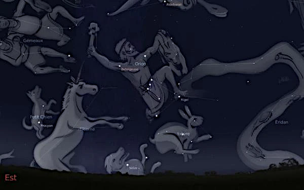 January sky
 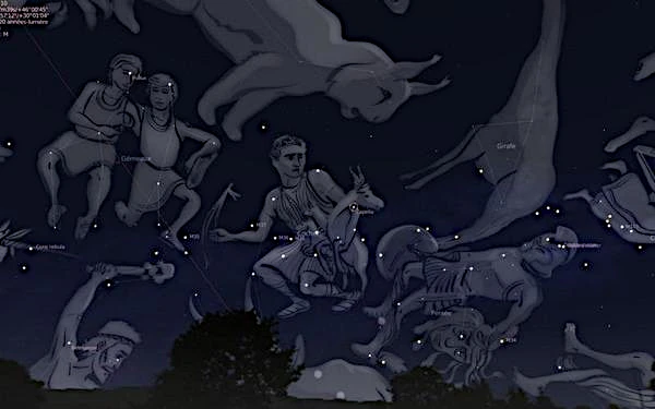 February sky
 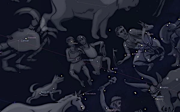 Mars Sky
 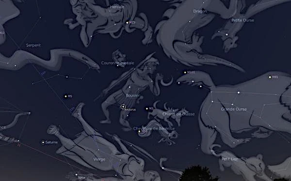 April sky
 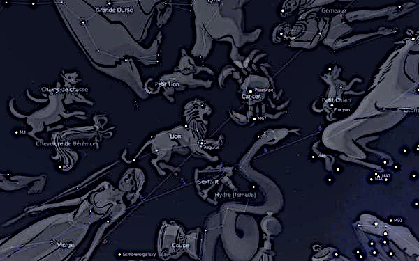 May Sky
 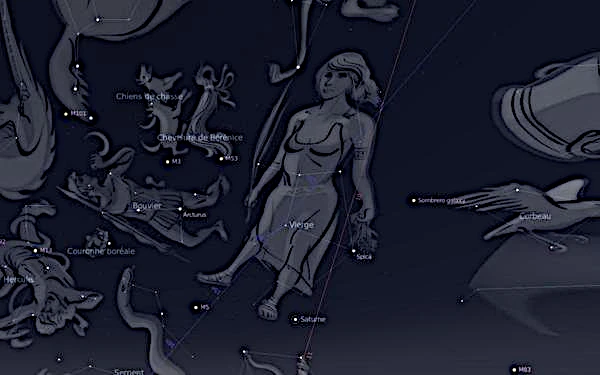 June sky
  July sky
  August sky
  September sky
  October Sky
  November sky
  December sky