There are several "firsts" depending on the criteria: the first photograph beyond the Kármán line in 1946, the first image transmitted from a satellite in 1959, the first full Earth disk from geostationary orbit in 1966, the first color image of the entire disk in 1967, the first view of Earth from lunar orbit in 1966, the first Earthrise photographed by humans in 1968, and the famous Blue Marble in 1972. Each marked a distinct technical and cognitive milestone.
N.B.:
The Kármán line is an altitude of 100 km above sea level, separating Earth's atmosphere from space. Beyond this line, the air is too thin, and the horizontal speed required to maintain flight exceeds orbital velocity, causing the craft to leave Earth and orbit instead.
N.B.:
Earth observation satellites are mainly divided into two categories: low Earth orbit (LEO) satellites, a few hundred kilometers above the surface, which provide high spatial resolution for detailed surface images and precise measurement of local phenomena; and geostationary orbit (GEO) satellites, at about 36,000 km, which remain fixed relative to the surface and allow continuous monitoring of global weather and climate phenomena.
| Year | Platform / Mission | What is "First" | Technical Details | Reference |
|---|---|---|---|---|
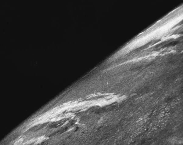
| 1946 | V-2 #13 (White Sands) | First photo of Earth from space (> 100 km) | 35 mm camera, altitude \(\sim 105\ \mathrm{km}\), recovered film | TIME; V-2 No. 13 |
| 1959 | Explorer 6 | First image transmitted by a satellite | Alt. \(\sim 27,000\ \mathrm{km}\), Pacific clouds, low resolution | NASA NSSDCA; NASA |
| 1966 | ATS-1 (Spin-scan) | First full disk from geostationary orbit | First "global weather" in a single shot | NOAA/NASA via Commons |
| 1966 | Lunar Orbiter 1 | First view of Earth from lunar orbit | Robotic "Earthrise" image, restored in 2008 | NASA LOIRP; The Planetary Society |
| 1967 | ATS-3 | First color image of the entire disk | Color camera, operational use in meteorology | BAMS 1968; The Planetary Society |
| 1968 | Apollo 8 | First Earthrise photographed by humans | Photo by Bill Anders, lunar orbit, color | NASA; Earthrise |
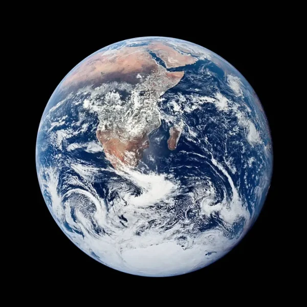
| 1972 | Apollo 17 | Blue Marble: Full Earth disk by humans | Photo AS17-148-22727, southern illumination | NASA; The Blue Marble |
Main sources: TIME – 1946 V-2; NOAA/NASA – ATS-1; BAMS 1968 – ATS-3; NASA – Lunar Orbiter 1; NASA – Apollo 8; NASA – Apollo 17.
Today, our view of Earth has become immediate, global, and continuous. It is no longer the result of sporadic space missions but comes from a dense network of observation satellites that monitor the planet 24/7.
These systems produce globally updated maps in near real-time, track extreme weather phenomena, deforestation, ice melt, and variations in ocean currents. The combination of observations from low Earth orbit (LEO) and geostationary orbit (GEO) provides both fine details and continuous planetary coverage.
 Plate Tectonics: The Invisible Engine Moving the Continents
  The Mystery of the Number 360: When Earth Imposes Its Geometry on the Circle
  Wet-Bulb Temperature: Humanity's Climate Time Bomb
 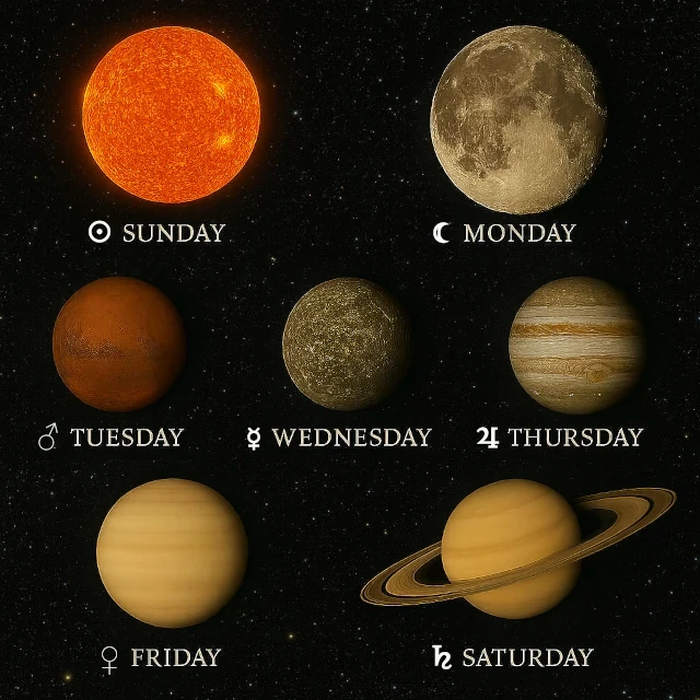 The Sky Ordered Our Week: Monday, Tuesday, Wednesday...
 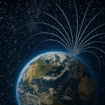 Why Doesn't Earth's Atmosphere Escape into Space?
  Origins of Earth: Magmatic Chaos and the Birth of the Solid World
  Earth's Atmosphere: The Invisible Shield Protecting Life
  The Three Ages of Terrestrial Water: Multiple Origins
  From Carbon 14 to Uranium-Lead: The Science of Dating
  The Boundary of Space: Where Does It Really Begin?
  The Leap Second
  Planetary Alignments: A Fascinating but Relative
Phenomenon
Planetary Alignments: A Fascinating but Relative
Phenomenon  All Deserts of the World
  Earth's Paleoclimates and Carbon Dioxide
  Three Gorges Dam and Day Length
  International Date Line
  Start Date of the Seasons: A Complex Celestial Mechanism
  Reversal of the Earth's magnetic field over time
  3D Simulator: Revolutions of the Planets
 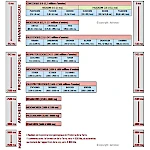 Geological Time and Mass Extinctions: From the Ordovician to the Cretaceous
  Earth History: Timeline Compressed into 24 Hours
  Earth's Water: An Extraterrestrial Origin?
 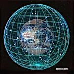 Reading the Sky: Understanding Declination and Right
Ascension
Reading the Sky: Understanding Declination and Right
Ascension  Inversions of the Earth's Magnetic Field
 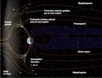 Earth's Magnetosphere: The Invisible Shield
 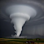 Fujita Scale: Classifying the Fury of Tornadoes
 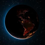 Earth's Radioactivity: The Internal Energy of Our Planet
  The Deep Sea: Exploring the Deepest Ocean Trenches
  Why Are Days Getting Longer?
  The Depths of the Earth: From the Lithosphere to the Core
 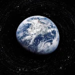 Earth's Movements: How Earth Traces Its Spiral Through the Universe?
 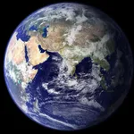 How much is the sea level rising?
 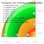 The Life of Earth: Structure and Layers of the Earth
  The Eccentricity of Earth's Orbit: An Ellipse That Changes
Everything
The Eccentricity of Earth's Orbit: An Ellipse That Changes
Everything 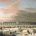 Little Ice Age: The History of a Natural Climatic Cooling
  The Quest for Time: How Ancient Civilizations Used
Astronomy?
The Quest for Time: How Ancient Civilizations Used
Astronomy? 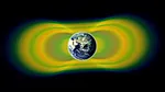 Van Allen Radiation Belt: A Shield Against Cosmic Particles
 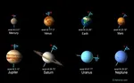 Axis of rotation of the planets or obliquity
  The Cosmos in Our Measure: When Man Invents the Universe
 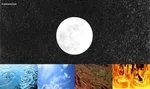 The Galilean Cut
  What is the pendulum fixed relative to?
  Problem of longitude at sea
  World population, still gallopingin 2008
  The Oldest Image of Earth from Space
  Earth's Obliquity and Variations in Its Axis of Rotation
 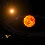 The Astronomical Unit Fixed: A Length, No Longer an Orbit
  One Molecule, Three States: Solid, Liquid, Gas on a Single Planet
  Simulator, the round of near-Earth cruisers
 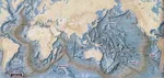 Satellites that measure underwater relief
  Hadean's Hell
 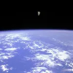 The First Free Flight of an Astronaut in Space
 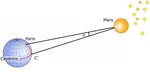 The first measurement of the Earth-Sun
distance
The first measurement of the Earth-Sun
distance  La The Announced End of the World on December 21, 2012: A Millennial
Prophecy
La The Announced End of the World on December 21, 2012: A Millennial
Prophecy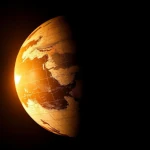 The Equinoxes: An Astronomical Event
 Milankovitch Cycles: The Astronomical Rhythm of Earth's Climate