The Andes Mountains is the largest mountain range in the world (7,100 kilometers long). It is located along the western coast of South America, passing through Venezuela, Colombia, Ecuador, Peru, Bolivia, Chile, and Argentina.
Its average altitude is 4,000 meters, and its highest peak is Aconcagua, located in Argentina, which rises to 6,962 meters above sea level. Many peaks are volcanoes created by the subduction of the Pacific plate beneath the South American plate. The main mountains of Colombia are: Pico Cristóbal Colón (5,775 m), Pico Simón Bolívar (5,775 m), Ritacuba Blanco (5,410 m), Nevado del Huila (5,365 m), Nevado del Ruiz (5,321 m), Nevado de Quindio (5,215 m), Nevado del Tolima (5,200 m), Galeras (4,276 m).
The main active volcanoes are: Cerro Machin volcano (2,750 m), Nevado del Ruiz volcano (5,320 m), Nevado del Huila volcano (5,365 m), and Galeras volcano (4,275 m).
N.B.:
The word "volcano" comes from Vulcano, one of the Aeolian Islands named in honor of Vulcan, the Roman god of fire. His equivalent in the Greek pantheon is Hephaestus. For the Romans, Vulcan is one of the three sons of Jupiter and Juno. Vulcan reigned as master in the fiery entrails of volcanoes.
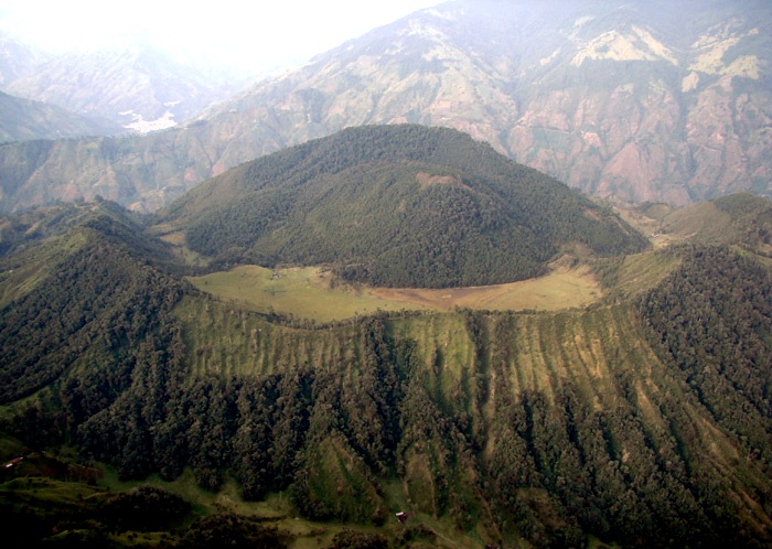
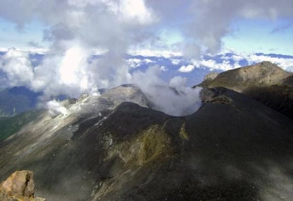
Cerro Machin has the lowest altitude of the volcanoes in Colombia (2,750 m). It is located 150 km southwest of Bogota, 17 km west of Ibague, 30 km east of the city of Armenia on the eastern slope of the central cordillera. Cerro Machin is in a region with a warm temperate climate with an average temperature of 20°C.
Although it has not erupted since the year 1180, it is an active volcano with three domes in the central ring. The center of the 2.4 km diameter crater is occupied by several domes with fumarolic activity and hot springs. In the crater of this explosive volcano, there is a magnificent crescent-shaped pond.
Cerro Machin, currently dormant, could well wake up in a strong explosion as in the past. The domes are actually the plugs of the volcanic vents from which, during the ancient explosions, tephras such as pyroclastic ashes and pumice stones, pyroclastic flows, and stone blocks as well as mudflows called lahars emerged.
Mudflows or lahars are generally of devastating power. They rush down the mountains and engulf everything in their path: trees, bridges, cars, buildings, etc. The volcanic activity of the Machin volcano has increased since 1998, with small earthquakes and fumaroles becoming more numerous. Geologists are attentive to radon gas emissions and possible deformations of the domes that obstruct the crater.
N.B.:
A lahar is a volcanic mudflow. It is mainly composed of water, volcanic ash, and tephras.
| Year (estimate) | Type of eruption | Consequences | Remarks |
|---|---|---|---|
| ~8500 BC | Plinian explosive (VEI 5–6) | Pyroclastic flows, major pyroclastic deposits | Cataclysmic eruption: deposits found over several tens of km |
| ~4000 BC | Sub-Plinian explosive | Ashfall, pyroclastic flows | Recurrent eruptive phase documented by stratified deposits |
| ~500 AD | Moderate explosive (VEI 3–4) | Pumice deposits, phreatomagmatic activity | Last major eruption identified by carbon-14 dating |
| Since 2008 (current activity) | Volcanic seismicity (no eruption) | Increased degassing, micro-earthquakes | Enhanced monitoring by SGC – no eruption to date |
Sources: Smithsonian Institution – Global Volcanism Program, Murcia et al. (2010), "The Cerro Machín volcano: Holocene explosive activity and current unrest".
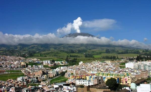
Nevado del Ruiz, covered by glaciers, is one of the highest volcanoes in Colombia (5,300 meters). It is also the second most active volcano after Galeras. Its glaciers surround the Arenas crater.
Nevado del Ruiz was formed by subduction volcanism and has experienced frequent Plinian eruptions during the Holocene, i.e., over the last 10,000 years. But it was in 1985 that one of Colombia's deadliest explosions occurred. It almost completely devastated the town of Armero. Since then, surveillance of this volcano has been constant because hundreds of thousands of people live in the surrounding valleys.
After 69 years of dormancy, Nevado del Ruiz erupted on September 11, 1985, until July 13, 1991. The lahar engulfed part of the town of Armero on the night of November 13-14, 1985, killing nearly 20,000 of the town's 29,000 inhabitants in their sleep. It was a disaster scenario as the pyroclastic flows from the crater carried the melted snow from the glaciers, and four enormous lahars rushed down the mountain slopes at 60 km/h. The lahars descended into the beds of the six rivers of the volcano and covered the town of Armero. The whole world remembers the video images of little Omayra Sánchez, 13, agonizing in a viscous mudflow.
N.B.:
A Plinian eruption is a type of volcanic eruption, with emissions of viscous lavas, that occurs on gray volcanoes. This lava blocks the volcanic vent, and the internal pressure increases in the volcano until it causes gigantic explosions that can destroy the volcano itself and give rise to a caldera.
| Year | Type of eruption | Consequences | Remarks |
|---|---|---|---|
| 1595 | Explosive (VEI 3) | Lahars, village destruction, ~600 deaths | First well-documented historical eruption |
| 1845 | Explosive (VEI 2–3) | Massive lahar, ~1,000 deaths | Mudflow along the Lagunilla river valley |
| 1985 | Explosive (VEI 3) | Armero destroyed, ~23,000 deaths | Major tragedy due to poor risk communication |
| 1989–1991 | Phreatomagmatic explosions | Ash, evacuations, air traffic disruptions | Moderate but prolonged activity |
| 2012 | Explosive (VEI 2) | Ash up to 8 km altitude, airport closures | No lahars, but high SO₂ emission |
| 2023 | Seismic activity + gas emission | Orange alert, enhanced monitoring | No major eruption, but high risk of lahar |
Sources: Smithsonian Institution – Global Volcanism Program, USGS – Ruiz Case Study.
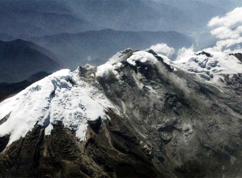
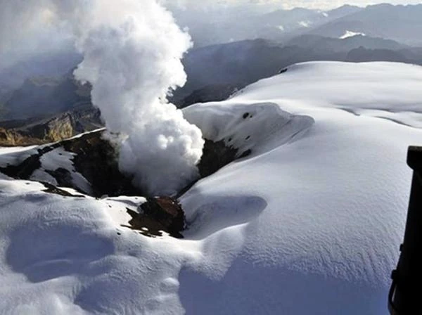
Nevado del Huila is a moderately active volcanic complex consisting of several stratovolcanoes and domes. It is located in the department of Huila (Colombia) in the central Andes mountain range. It is the highest volcano in the Colombian Andes (between 5,364 and 5,750 meters) and is therefore covered by an ice cap.
This volcano was built in an ancient caldera ten kilometers in diameter from which several volcanic domes emerge: Pico Norte, Pico la Cresta, Pico Central, and Pico Sur. The volcanism of Nevado del Huila has produced six volcanic cones. It is currently an enormous mountain (16 km x 11 km). The only activity is the noise of its permanent rumbling.
| Year | Type of eruption | Consequences | Remarks |
|---|---|---|---|
| ~1550 (uncertain) | Unknown | Undocumented | Last presumed eruption before the modern historical period |
| 2007 (February–April) | Phreatic explosive | Mudflows (lahars), evacuations | Sudden awakening after several centuries; glacier activation |
| 2008 (November) | Explosive VEI 3 | Partial destruction of the glacier, 10 deaths, national alerts | Ash emissions up to 12 km altitude |
| 2009 (May–November) | Intermittent explosions | Minor pyroclastic flows and lahars | Prolonged eruptive phase, high alert level |
| 2012 (June) | Moderate explosion | Preventive evacuations | Declining activity after 5 years of volcanic vigilance |
Sources: Smithsonian Institution – Global Volcanism Program.
The Galeras volcano is a stratovolcano in the Andes in the Colombian department of Nariño, 9 km from the capital San Juan de Pasto. The Indians had given it the name "Urcunina", which means Mountain of Fire. Then the Spanish conquerors called it "Galeras" because of its resemblance to galleys or sailing ships.
The Galeras volcano is best known as a volcanic complex. It has a conical shape, and the western part of the structure is destroyed. Its summit rises to 4,276 meters above sea level. It has frequently erupted since its historical eruption on December 7, 1580.
The Galeras has been an active volcano for at least a million years, mainly spewing andesite. The ancient major eruptions built the caldera, part of whose wall is currently collapsed. Inside the caldera, there is a small horseshoe-shaped cone.
N.B.:
Andesite is a gray volcanic igneous rock, characteristic of volcanism in subduction zones.
| Year | Type of eruption | Consequences | Remarks |
|---|---|---|---|
| 1936 | Moderate explosive | Local damage | First modern scientific records |
| 1989 | Explosive | Evacuation of Pasto | Start of permanent volcanic monitoring |
| 1993 | Sudden explosive | 9 deaths (including scientists) | Eruption during a field campaign |
| 2004–2010 | Intermittent explosions | Ash flows | Prolonged eruptive phase |
Sources: Smithsonian Institution – Global Volcanism Program.
 Overview of European Volcanoes: From Etna to Vesuvius
  Overview of African Volcanoes: From Kilimanjaro to Nyiragongo
  Overview of North American Volcanoes: From Mount Saint Helens to Popocatépetl
 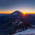 Overview of South American Volcanoes: From Aconcagua to Cotopaxi
 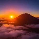 Overview of Asian Volcanoes: From Fuji to Krakatoa
  Overview of Oceania's Volcanoes: From Indonesia to New Zealand
 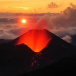 Global Overview of Volcanoes: A World Tour of Fire Giants
  The Toba Super Eruption: Decades of Climatic Chaos
 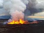 Mauna Loa is the largest volcano in the world!
 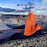 Earth's Great Volcanoes: Red Fury, Gray Silence
  Volcanoes of Kamchatka: The Realm of Icy Volcanoes
  The Titans of Fire: Origin, Power, and Risks of Supervolcanoes
  Active Volcanoes of Colombia: Between Natural Beauty and Eruptive Risks
 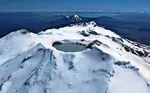 New Zealand's Volcanoes: A Natural Laboratory for Plate Tectonics
  Volcanoes and the Origin of Life: When Fire and Water Spark Chemistry
  Underwater Eruptions and the Emergence of New Lands
 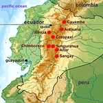 Volcanoes of Ecuador: Giants of Fire
 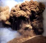 Catastrophe of a Super Eruption
  The Largest Calderas in the World: Earth's Scars
  Supervolcanoes are invisible!
 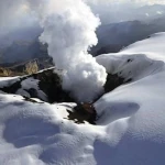 The Nevado del Ruiz volcano
 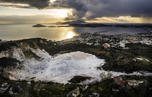 The Phlegraean Fields
 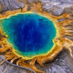 The Yellowstone Supervolcano
 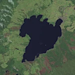 The spectacular caldera of Lake Taupo
 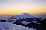 Chimborazo: The Highest Peak on the Planet!