fr en es pt
Astronomy
 
Contact the author rss astronoo


Volcanoes of Ecuador

Volcanoes in the Ring of Fire in Ecuador

Updated June 01, 2013

Ecuador is surrounded by Peru and Colombia, it is located in South America, on both sides of the Andes, which crosses the country from north to south.
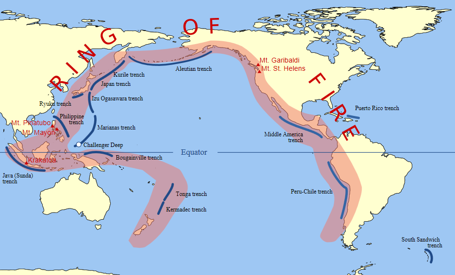
Ecuador is on the "Ring of Fire" Pacific is an alignment of terrestrial volcanoes and submarine oceanic depressions. The volcanoes bordering the Pacific Ocean on the majority of its circumference, or about 40,000 km. This area is called "Ring of Fire".
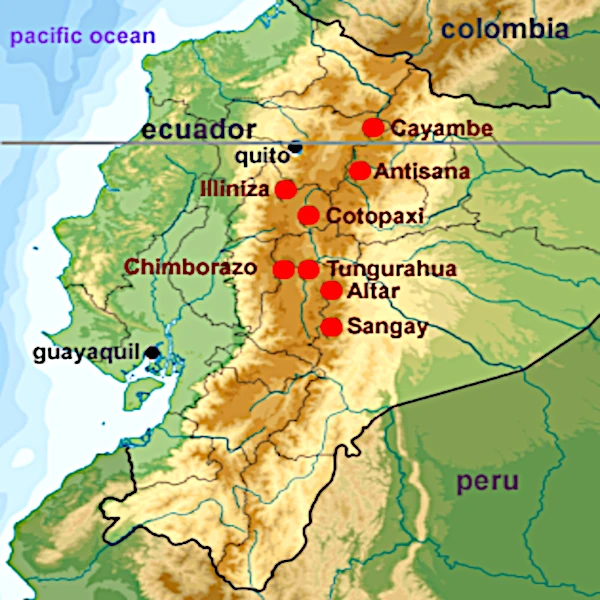
The country's name comes from its position on the equator. Quito is the capital and largest city is Guayaquil. In Ecuador, the Andes is split into two parallel chains, each containing several volcanoes 5000 meters and more. The country's highest point is in the Western Cordillera is the Chimborazo (6268 m).
In the Eastern Cordillera there is the highest active volcano in the world, Cotopaxi (5897 m).
The two mountain ranges are separated by a depression of 600 km, a valley at an altitude between 2500 and 3000 meters.

Volcanoes AltitudeLast eruption
   
Chimborazo 6 310 m640
Cotopaxi 5 897 m1942
Cayambe 5 790 m1785-1786
Antisana 5 753 m1801-1802
Altar 5 321 m≈1460
Illiniza 5 248 m?
Sangay5 230 m1934
Tungurahua5 023 m2010
Volcanoes in the Ring of Fire in Ecuador

Image: The double row of volcanoes in Ecuador the Andes cordillera is split into two parallel chains, each containing several volcanoes 5000 meters and more.

Pacific Ring of Fire line of volcanoes, ocean trenches

Image: Volcanoes are distributed along tectonic zones of the earth's crust. The most spectacular example is the line of volcanoes that runs through much of the Pacific Ocean, called the "Ring of Fire". Volcanic eruptions give rise to popular belief mingling terror, superstition and legend fantastic.

NB: Gray volcanoes eruptions explosive emit pasty lava and ash in the form of pyroclastic flows and volcanic plumes.
The word "volcano" comes from Vulcano, one Aeolian Islands named after Vulcan, the Roman god of fire. Vulcan reigned master in the bowels burning volcanoes.

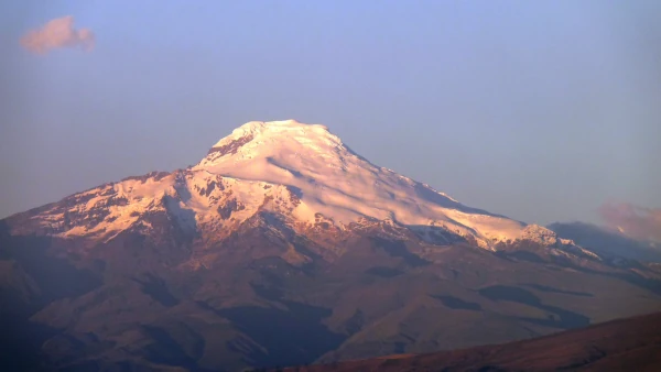
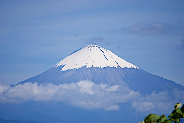
Chimborazo volcano (Ecuador)

ChimborazoVolcan Chimborazo en Equateur is an inactive volcano in Ecuador, which rises to 6,310 m above sea level, is the highest peak in the Ecuadorian Andes. It is located 1 ° south of the equator. Its last known eruption date Av 550 BC.
This stratovolcano dominates 2500 meters the surrounding highlands, the base has a width of about 20 km. From the summit you can see, if the weather is good, the city of Guayaquil situated about 140 km.
The nearest cities are Riobamba at ≈ 30 km southeast, Ambato at ≈ 30 km northeast Guaranda and at ≈ 25 km southwest. Chimborazo is surrounded by a protected ecosystem preserving habitat Andean camelids, vicunas, llamas and alpacas. The summit of Chimborazo is completely covered by ice, glacier arm down the northeast to 4600 m.
Its glacier is the source of water for the population of the province of Bolivar. Like many glaciers in the world, the Chimborazo has decreased in recent decades. Like other Ecuadorian mountains glaciers of Chimborazo operated by the local population for its ice to be sold on the markets of Guaranda and Riobamba. Although Everest, Tibetan mountain, rises to an altitude of 8848 meters, the Chimborazo is actually the highest peak of the world, the closest the sky or the sun.

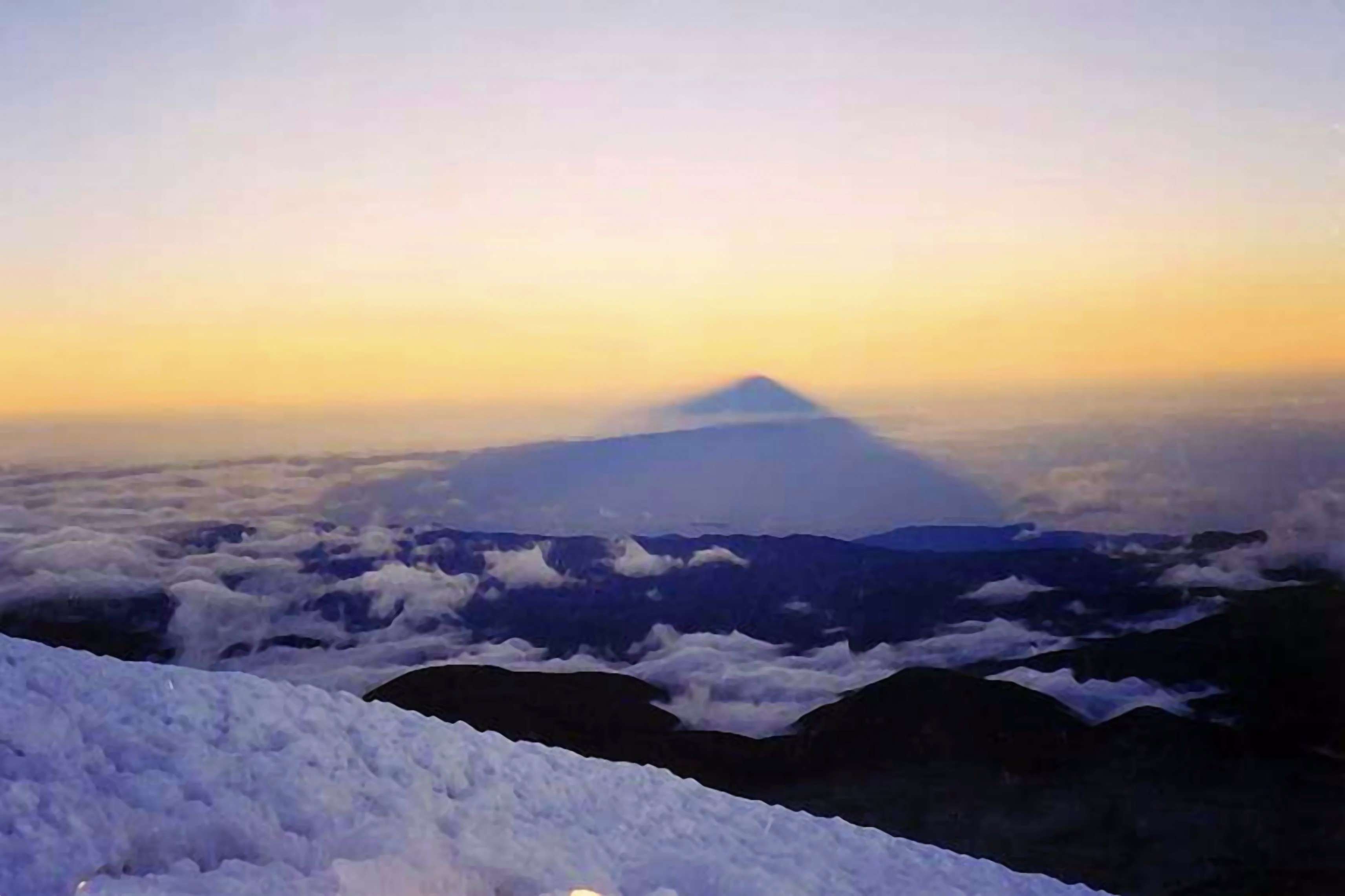
The summit of Chimborazo is the fixed point on the Earth is farthest from the center, due to the flattened spheroid of our planet. The equatorial radius of the Earth is 6378.137 km and the polar radius of 6356.752 km, which makes a difference of 21,385 km.
Chimborazo is closer to the equator while Everest is 27 degrees latitude.
Comparison of absolute heights:
Height of Mount Everest = 8848 meters
Height of Chimborazo = 6268 meters
Radius of the Earth loses 21385/90 = 237.6 m all degrees of latitude.
Everest is located at 27 ° 59'17 "N.
Radius of the Earth under the Everest:
6378137 - (27.5 * 237.6) = 6 371 603 m
Height of Everest over the space:
6 371 603 + 8 848 = 6 380 451 meters
Chimborazo is located 1 ° 27'50 "S.
Radius of the Earth under the Chimborazo:
6378137 - (1.5 * 237.6) = 6 377 780 meters
Chimborazo height relative to the space:
6 377 780 + 6 268 = 6 384 048 meters
Chimborazo is closer to heaven than 3597 meters.

Chimborazo the highest mountain of the world

Image: Chimborazo the highest peak of the Ecuadorian Andes is also the peak closest to the sky because its summit is the farthest from the center of the Earth. We can say that it is the highest peak of the planet, 3597 meters higher than Everest, the mountain of Tibet.

Cotopaxi volcano (Ecuador)

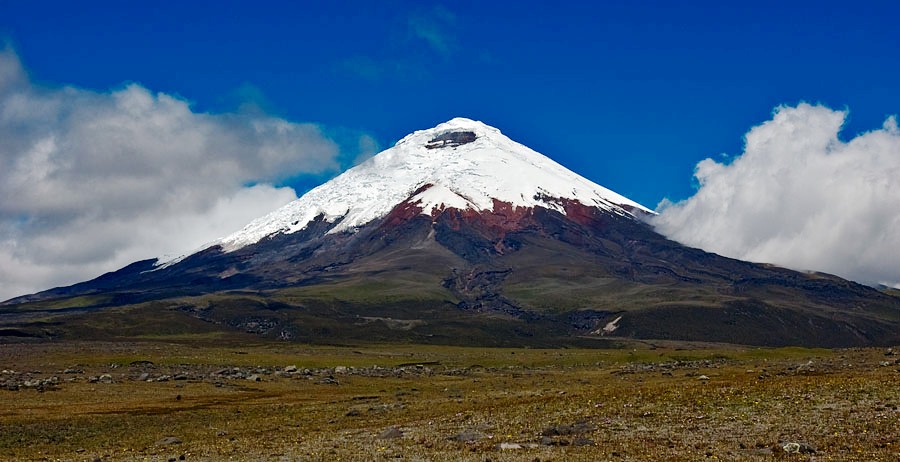
The CotopaxiVolcan Cotopaxi en Equateur volcano rises to 5897 meters above sea level, located southeast of Quito, on the western edge of the Cordillera Central.
This is the highest active volcano in Ecuador, it is visible from Quito. Perfect cone shape, this magnificent stratovolcano The stratovolcano is a volcanic mountain that is formed by the accumulation over the eruptions of lava and ash levels. The stratovolcano is an explosive volcanism volcano, which is characterized by very steep slopes, and the presence of a dome at the top, made of lava very viscous and filled with gas. Etna, Sicily, Kilimanjaro, Tanzania, and Merapi, on the island of Java in Indonesia are examples of stratovolcanoes.  Ring of Fire 22 kilometers long and 20 kilometers wide, dominates the National Park Cotopaxi, 3000 meters below.
Like Mount Fuji in Japan, Cotopaxi has a symmetrical shape and perfect from 4900 meters, Cotopaxi is covered with eternal snow. Two beautiful nested craters are traces of volcanic activity.
Since 1738, Cotopaxi erupted fifty times. The numerous valleys drawn by mudflows (lahars) are the remnants of this activity around the volcano. Since the 2000s, the activity increases with emissions more important fumaroles. The main danger of Cotopaxi is the huge mass of ice and snow could hit the slopes of this mountain during an eruption of the volcano.

The inclination of the flanks is observed of approximately 30 °, while the diameter of its base is 15 km. The crater is oval 800x600 meters with a depth of 200 meters.
This active volcano appeared in the middle of the Pleistocene between 200,000 and one million years old volcanic layers. The late Pleistocene to the present day, following many destructive explosive eruptions, Cotopaxi cone built today.
In 1802, Alexander von Humboldt was the first European to climb Cotopaxi, but it could not reach the summit. This is a German team, led by Wilhelm Rajss which reached the first summit in 1872.

NB: A lahar is a mudflow of volcanic origin. It is mainly composed of water, volcanic ash and tephra.

Cotopaxi volcano rises to 5897 meters

Image: Cotopaxi means "neck of the moon" in Quechua, the indigenous peoples of the Andes consider it as a sacred mountain. Cotopaxi is one of the images that define the Equator.


1997 © Astronoo.com − Astronomy, Astrophysics, Evolution and Ecology.
"The data available on this site may be used provided that the source is duly acknowledged."