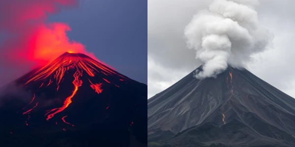
Volcanoes are one of the most spectacular manifestations of our planet's internal dynamics. These fire giants alternate between periods of intense activity—"red fury"—and long phases of rest—"gray silence." This fascinating duality reflects the titanic forces at work deep within the Earth.
Volcanism results from the rise of magma from the depths of the mantle. When pressure becomes too great, magma breaks through the Earth's crust, leading to an eruption. The viscosity of magma, determined by its silica content \( \text{SiO}_2 \), directly influences the type of eruption.
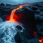
There are primarily two types of volcanism: effusive volcanism, characterized by fluid lava flows, and explosive volcanism, producing massive ash and gas plumes. The distribution of volcanoes on the globe is not random; it mainly follows tectonic plate boundaries.
Between eruptions, volcanoes enter dormancy phases that can last from a few years to several millennia. During these "gray silences," magmatic activity continues beneath the surface, sometimes preparing for the next "red fury." Monitoring these precursor signals is crucial for volcanic risk prevention.
| Volcano Type | Magmatic Composition | Eruption Type | Famous Examples | Average Periodicity |
|---|---|---|---|---|
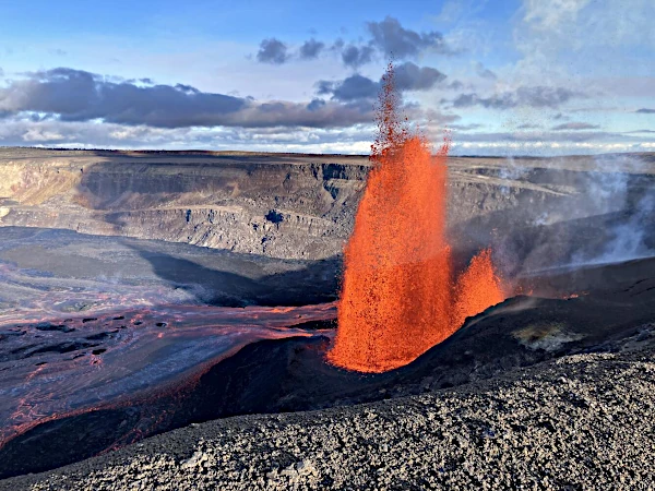
| Shield Volcano | Fluid basaltic magma | Effusive | Kīlauea (Hawaii), Piton de la Fournaise | Almost continuous |
| Stratovolcano | Viscous andesitic magma | Explosive | Vesuvius, Mount St. Helens, Mount Fuji | Decades to centuries |
| Gray Volcano | Silica-rich magma | Highly explosive | Mount Pelée, Krakatoa | Centuries to millennia |
Source: Smithsonian Institution - Global Volcanism Program and United States Geological Survey - Volcano Hazards Program.
Major volcanic eruptions can influence the global climate for several years. Sulfate particles emitted into the stratosphere reflect solar radiation, causing temporary cooling. The 1991 Pinatubo eruption lowered the global average temperature by about 0.5°C for two years.
Understanding the cycle of "red fury" and "gray silence" is essential for coexisting with these natural forces. Advances in volcanology, particularly through the work of Haroun Tazieff (1914-1998) and Katia Krafft (1942-1991), now allow us to better anticipate risks while preserving the riches volcanoes offer humanity.
| Volcano | Country/Region | Elevation (m) | Type | Last Eruption | Notable Features |
|---|---|---|---|---|---|
| Kīlauea | Hawaii, USA | 1,247 | Shield volcano | 2023 | One of the world's most active volcanoes, nearly continuous eruption |
| Etna | Sicily, Italy | 3,357 | Stratovolcano | 2024 | Europe's tallest active volcano, frequent activity |
| Piton de la Fournaise | Réunion, France | 2,632 | Shield volcano | 2024 | One of the planet's most active volcanoes |
| Popocatépetl | Mexico | 5,426 | Stratovolcano | 2024 (ongoing) | Highly populated surroundings, significant threat |
| Stromboli | Aeolian Islands, Italy | 924 | Stratovolcano | 2024 (ongoing) | Constant Strombolian activity for 2,000 years |
| Eyjafjallajökull | Iceland | 1,666 | Stratovolcano | 2010 | Famous eruption that disrupted European air traffic |
| Vesuvius | Italy | 1,281 | Stratovolcano | 1944 | Famous for the 79 AD eruption that destroyed Pompeii |
| Krakatoa | Indonesia | 813 | Caldera | 2022 | Cataclysmic 1883 eruption, one of the most violent |
| Fuji | Japan | 3,776 | Stratovolcano | 1707 | National symbol of Japan, dormant but active |
| Yellowstone | Wyoming, USA | 2,805 | Supervolcano | - | 70 km caldera, cataclysmic eruptive potential |
Source: Smithsonian Institution - Global Volcanism Program and United States Geological Survey.
 Overview of European Volcanoes: From Etna to Vesuvius
  Overview of African Volcanoes: From Kilimanjaro to Nyiragongo
 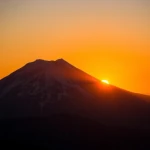 Overview of North American Volcanoes: From Mount Saint Helens to Popocatépetl
  Overview of South American Volcanoes: From Aconcagua to Cotopaxi
  Overview of Asian Volcanoes: From Fuji to Krakatoa
  Overview of Oceania's Volcanoes: From Indonesia to New Zealand
 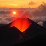 Global Overview of Volcanoes: A World Tour of Fire Giants
 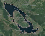 The Toba Super Eruption: Decades of Climatic Chaos
 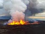 Mauna Loa is the largest volcano in the world!
 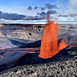 Earth's Great Volcanoes: Red Fury, Gray Silence
 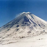 Volcanoes of Kamchatka: The Realm of Icy Volcanoes
 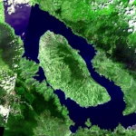 The Titans of Fire: Origin, Power, and Risks of Supervolcanoes
  Active Volcanoes of Colombia: Between Natural Beauty and Eruptive Risks
 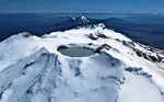 New Zealand's Volcanoes: A Natural Laboratory for Plate Tectonics
 Volcanoes and the Origin of Life: When Fire and Water Spark Chemistry
 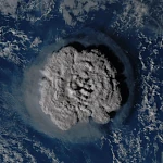 Underwater Eruptions and the Emergence of New Lands
 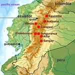 Volcanoes of Ecuador: Giants of Fire
 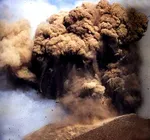 Catastrophe of a Super Eruption
 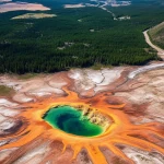 The Largest Calderas in the World: Earth's Scars
 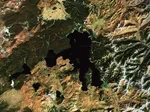 Supervolcanoes
are invisible!
Supervolcanoes
are invisible! 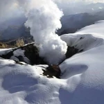 The Nevado del Ruiz volcano
 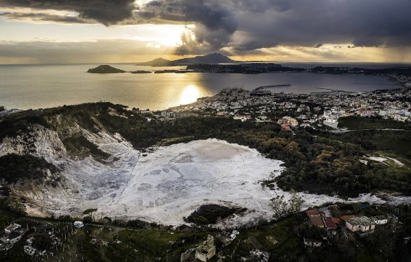 The Phlegraean
Fields
The Phlegraean
Fields 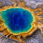 The Yellowstone
Supervolcano
The Yellowstone
Supervolcano 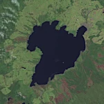 The spectacular
caldera of Lake Taupo
The spectacular
caldera of Lake Taupo 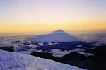 Chimborazo: The Highest Peak on the Planet!