Sahara
The age of the Sahara
The Sahara stretches from the Atlantic Ocean to the Red Sea for a length of 5200 km and a width of 1 500 km or 9 million km2 of desert. The Sahara is permanently altered by the erosion of hot winds, it is devoid of vegetation.
Maximum temperatures in the warmer parts of the world, exceeding 50 ° C. The temperature record was recorded in the Sahara, with 58 ° C in Libya Al Azizia. Analysis of fossil dune formations in Chad by researchers at the CNRS in February 2006 (Science magazine), has determined the age of the Sahara, the largest desert in the world. It would not be 86,000 years old, as we believed, but at least 7 million years. According to the CNRS, a few thousand years, the location of the current Sahara ran a humid climate where there were many rivers and lakes, including Lake Mega-Chad.
The Sahara is currently in a period other desert but desert earlier episodes were recorded, the oldest dating back 86,000 years.
Note: The word Sahara comes from Arabic (al-Kubra, "The largest desert"). The largest desert in the world occupies about 10% of the African continent.
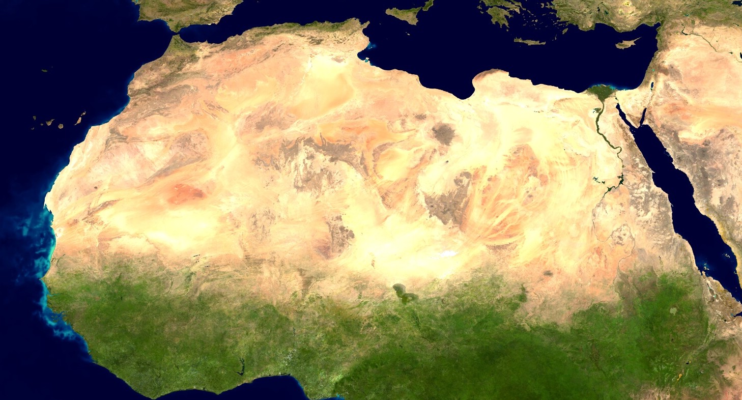
Image: Satellite image of the largest desert in the world, the Sahara (9 million km2) extending largely in Morocco, Algeria, Tunisia, Libya, Egypt, Mauritania, Mali, Niger, Chad and Sudan (Google maps).
The geography of the Sahara
The ergs are the great mass of dunes, they occupy about 20% of the surface of the Sahara. They evolve according to prevailing winds.
The regs are flat expanses, rocky landscape and are the most common of the Sahara. The reg's Tanezrouft which means "land of thirst" is located in Algeria.
The dayas are of limited extension basins, deep usually clay where water runoff can accumulate. These are areas of vegetation that is found mainly north of the Sahara.
The sabkha salt marshes are temporary. The water from temporary sources. The sabkha of Chott el Jerid, covers 5 000 km ².
The hamadas are trays tabular rock smoothed by wind erosion. When covered with stone, they are appointed as the Tassili Tassili Ajjer in Algeria.
The Jebel means all other reliefs.
The Saharan oases, only one thousandth of the surface of the Sahara. Oases are often located on the river bed or at the foot of large clumps.
The guelta is a water flow without visible. They were discovered in the form of pools in the beds of wadis, or in crevices of rock masses protected from sun exposure.
The wadis are streams temporary, most of the time they are dry.
The Tenere, or "desert" is the central Sahara.
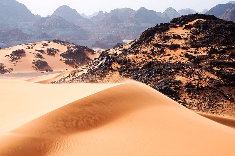
Image: Dunes, cliffs and mountains in the Tadrart Acacus, south-west of Libya in the Sahara.
The country of the thirst
Tanezrouft is a region straddles the Sahara to Algeria and Mali, west of the Hoggar and extends 500 km from Reggane to the Mali border. s
Tanezrouft is Considered an absolute desert due to extreme Aridity. This vast plain avoided by caravans, has no point of water. In the 20th century, they found the mummified remains of a caravan of 1 800 camels and 1 500 men. His first official crossing by camel by a European is attributed to Captain Cortier in 1913.
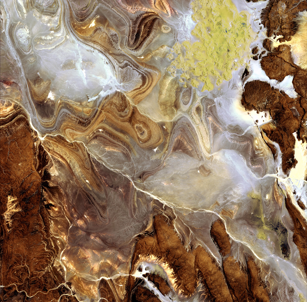
This beautiful view of the Watershed area Tanezrouft, the "Land of Thirst", describes one of the Driest regions of the Algerian Sahara.
In the picture-cons, the basin Tanezrouft shows its dark hills of sandstone, traces of white salt and Rocky Plateaus. In the top right of the picture, Erg Mehedjibat appears as a small audience of yellow dunes.
Rainfall is very rare and irregular in the Sahara and most regions are on average less than 130 mm of rain per year. Tanezrouft can take several years without receiving any rain.
Despite its aridity, the region is home Tanezrouft however, two cities, and Taoudeni Teghazza famous for their mining of rock salt and Tuareg caravans make market when Azalaï year.
Note: The caravans of camels carrying the famous slabs of salt across the desert, and the shipments they make are called Azalaï Tamashek language.
Image: The Japanese satellite ALOS (Advanced Land Observation Satellite) took this picture with a resolution of 10 meters, June 24, 2009 using his camera AVNIR-2 (Advanced Visible and Near Infrared Radiometer type-2) designed to establish the map of land surface and vegetation.
Articles on the same theme
 The Demographic Transition: Growth or Decline?
 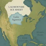 Lake Agassiz: A Deluge that Changed the Climate
 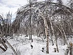 Drunken Forests: Understanding the Phenomenon of Permafrost Thaw
  There is Electricity in the Air!
  Why Doesn't CO2 Fall to the Ground?
 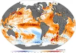 Dramatic Consequences of the El Niño Phenomenon
  Will man be the biggest animal on Earth?
  Acid
rain beyond the natural
Acid
rain beyond the natural  Global warming
 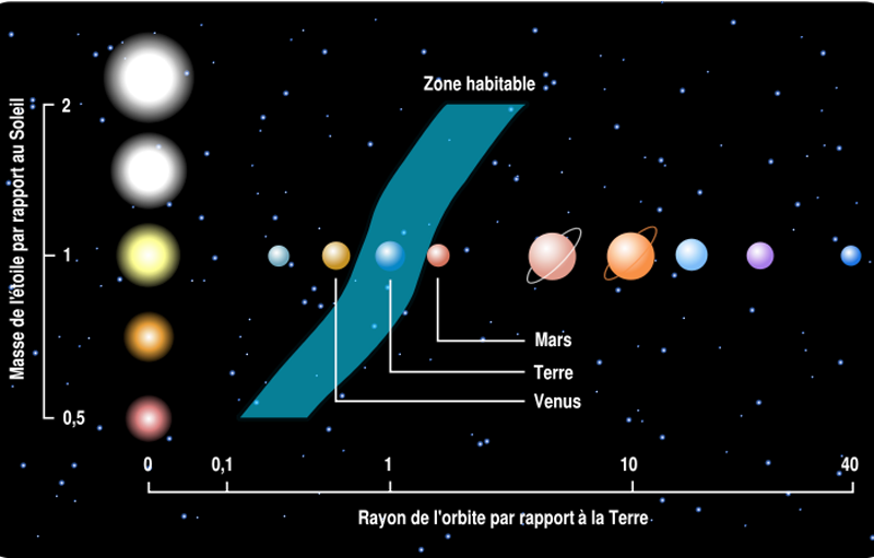 Habitable zones or ecosphere of stars
  Ocean water from elsewhere
  Sustainable development, the living are watching us
 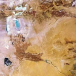 The Aral Sea: A Lesson for Humanity
 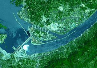 The largest dam in the world
 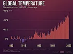 The Hottest Years Since Records Began
  Magnitude of future global warming
  Earth in Crisis: Collapse or Renaissance?
 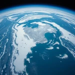 Ice on the Brink: The Inevitable Decline of Arctic Sea Ice
  Earth's Water Reservoirs: From Oceans to Groundwater
 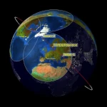 Sea Levels Are Rising, But How Fast?
  Global Dimming: A Dangerous Respite in the Climate Crisis
 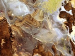 The Land of Thirst
  World Population from 1800 to 2100
  Oil: The Fall of a Giant in the Era of Renewable Energy
  Kamchatka King Crab: A Giant of the Oceans
  The
collapse of a society
The
collapse of a society  Slight Progress in the Global Ecological Footprint
  The South Atlantic Anomaly
  The phenomenon of soil sinking is called subsidence
 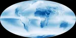 The disturbing cloud cover of the Earth
  The Planet's New Clouds
1997 © Astronoo.com − Astronomy, Astrophysics, Evolution and Ecology.
"The data available on this site may be used provided that the source is duly acknowledged."
How Google uses data
Legal mentions
English Sitemap − Full Sitemap
Contact the author