Water on Earth is stored in various reservoirs, from oceans to deep groundwater. These reservoirs are essential for maintaining ecosystems and supplying freshwater to humanity.
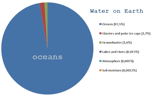
Most of Earth's water is found in the oceans, about 97.5% of the total volume. Freshwater accounts for only 2.5%, most of which is frozen in polar ice caps or glaciers.
| Reservoir | Estimated Volume (km³) | % of Total | Comment |
|---|---|---|---|
| Oceans | 1,350,000,000 | 97.5% | Main saltwater reservoir |
| Glaciers and Polar Ice Caps | 24,000,000 | 1.7% | Frozen freshwater, mainly in Antarctica and Greenland |
| Groundwater | 13,500,000 | 1.6% | Includes accessible and deep aquifers |
| Lakes and Rivers | 200,000 | 0.015% | Surface freshwater available for consumption and irrigation |
| Atmosphere | 12,900 | 0.001% | Water in the form of vapor and clouds |
| Soil Moisture | 16,500 | 0.0012% | Water accessible to plants and microorganisms |
Although freshwater represents only about 2.5% of the total water on Earth, its actual availability for ecosystems and human use is even more limited. Most of it is frozen in glaciers and polar ice caps (1.7%), leaving only a small fraction as groundwater, lakes, and rivers.
Accessible freshwater constitutes a tiny fraction of the total terrestrial water, highlighting the importance of sustainable management and protection of aquifers and watercourses for future generations.
Groundwater is the largest accessible freshwater reservoir, with about 13.5 million km³. It is stored in aquifers at various depths. Renewal is slow, ranging from hundreds to thousands of years, depending on rock permeability and recharge by infiltration. Deep aquifers sometimes contain fossil water, which is non-renewable on a human timescale.
Surface water (lakes, rivers, artificial reservoirs) represents only 0.015% of the total volume of Earth's water but is vital for drinking water, irrigation, and industry. Its availability varies greatly by region and season. Major tropical rivers concentrate a significant portion of this water, while arid areas rely mainly on groundwater.
The atmosphere and soil moisture, although representing a small volume compared to oceans or aquifers, are essential to the hydrological cycle. They ensure the redistribution of freshwater through precipitation and the direct supply of terrestrial ecosystems.
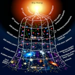
 The Principle of Least Action: Why Does Nature Always Choose the Most Economical Path?
  Evolutionary Convergence: Chance, Necessity… or Mirage?
 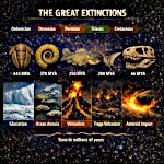 The Five Mass Extinctions: What do these planetary catastrophes reveal?
 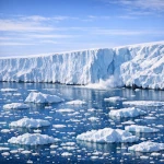 Cryosphere: when the ice giants still protect us
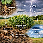 The Nitrogen Cycle: From Air to Life
  The Jet Stream: When the Atmospheric River Overflows Its Banks
 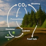 The Carbon Cycle: The Harmonious Interaction of Oceans, Forests, and Subsoils
  The Water Paradox: Without it, no life
  Why 220V Alternating Current is in Our Outlets: A Matter of Physics
  The Last Glacial Shock: The Younger Dryas and Its Impact on Prehistoric Societies
  The Minimal Cell: The Inevitable Emergence
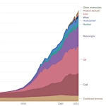 Evolution of Global Energy Consumption: From Steam Engines to Digital Servers
 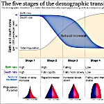 The Demographic Transition: Growth or Decline?
 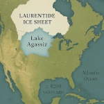 Lake Agassiz: A Deluge that Changed the Climate
 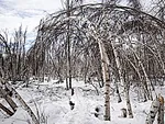 Drunken Forests: Understanding the Phenomenon of Permafrost Thaw
 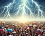 There is Electricity in the Air!
 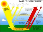 Why Doesn't CO2 Fall to the Ground?
 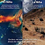 El Niño and La Niña: The Two Breaths of the Pacific That Shape Global Climate
  Endangered Species: Dynamics of Extinction
  The Toxic Legacy of Acid Rain
  Global Warming in Figures: What the Scientific Data Says
  What is Sustainable Development?
 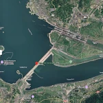 Three Gorges Dam: Impacts on Ecosystems
 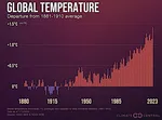 The Hottest Years Since Records Began
 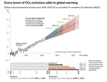 Magnitude of future global warming
 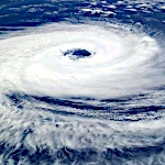 Earth in Crisis: Collapse or Renaissance?
 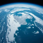 Ice on the Brink: The Inevitable Decline of Arctic Sea Ice
 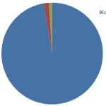 Earth's Water Reservoirs: From Oceans to Groundwater
  Sea Levels Are Rising, But How Fast?
  The Other Climate Threat: Earth Shrouded in Shadow and Humidity
  The Age of the Sahara: From Green Prairie to Stone Desert
 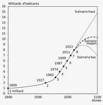 World Population from 1800 to 2100
 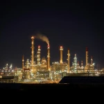 Oil: The Fall of a Giant in the Era of Renewable Energy
  Kamchatka King Crab: A Giant of the Oceans
  The collapse of a society
  Slight Progress in the Global Ecological Footprint
 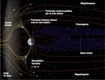 The South Atlantic Anomaly
  The phenomenon of soil sinking is called subsidence
 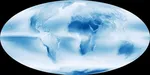 Why Is Earth So Often Cloudy?
 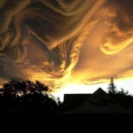 The Planet's New Clouds
 Desertec: A Solar Dream for Europe and Africa