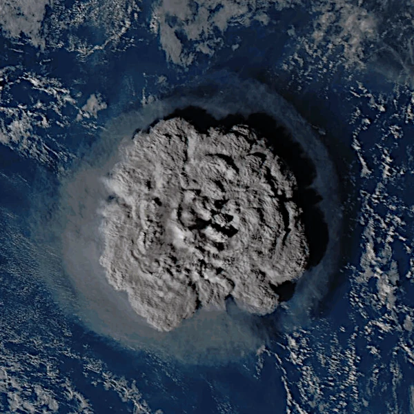
An underwater eruption occurs when magma reaches the ocean floor, causing intense contact with water. This interaction generates rapid vaporization, forming columns of steam and ash. The magma cools quickly, creating hyaloclastite basalts that accumulate to build a volcanic edifice. Gradually, if the volume of magma is sufficient and the eruption is sustained, the structure may emerge at the surface, giving birth to an island.
N.B.:
The term hyaloclastite comes from the Greek hyalo- meaning "glass" and -clastic meaning "broken" or "fragmented". Hyaloclastite basalts are volcanic rocks formed by the rapid cooling of magma in contact with water. This process causes the magma to fragment into glassy grains and angular fragments, constituting a typical deposit of underwater eruptions.
When an underwater volcano erupts, magma, which can reach temperatures between 1100 and 1250 °C, meets very cold seawater. This encounter causes instant cooling of the magma, forming fragments (hyaloclastite basalts). These fragments gradually accumulate to build the base of a future volcanic edifice.
The process involves intense heat transfer. The amount of heat exchanged shows how quickly thermal energy is dissipated into the water, causing immediate vaporization and the formation of steam columns.
The interaction between magma and water can also cause phreatomagmatic explosions. These small explosions further fragment the magma, producing fine ash and scoria that facilitate the rise of the volcanic edifice. Over time, if the volume of magma is sufficient and the eruption continues, the structure may emerge at the surface and create an island.
These eruptions can generate local tsunamis, alter marine currents, and cause temporary acidification of the water. The emissions of volcanic gases, mainly CO2 and SO2, can also affect the atmosphere and surrounding ecosystems.
| Parameter | Typical value | Unit | Comment |
|---|---|---|---|
| Magma temperature | 1100 - 1250 | °C | Typical basalt of oceanic eruptions |
| Eruption rate | 10 - 50 | m³/s | Influences the growth of the volcanic edifice |
| Eruption depth | 0 - 500 | m | Determines the type of magma-water interaction |
| Cumulative volume for emergence | 1 - 10 × 10⁶ | m³ | Variable depending on topography and marine currents |
 Overview of European Volcanoes: From Etna to Vesuvius
  Overview of African Volcanoes: From Kilimanjaro to Nyiragongo
  Overview of North American Volcanoes: From Mount Saint Helens to Popocatépetl
  Overview of South American Volcanoes: From Aconcagua to Cotopaxi
  Overview of Asian Volcanoes: From Fuji to Krakatoa
  Overview of Oceania's Volcanoes: From Indonesia to New Zealand
 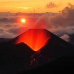 Global Overview of Volcanoes: A World Tour of Fire Giants
 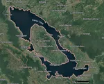 The Toba Super Eruption: Decades of Climatic Chaos
 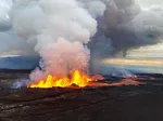 Mauna Loa is the largest volcano in the world!
 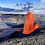 Earth's Great Volcanoes: Red Fury, Gray Silence
  Volcanoes of Kamchatka: The Realm of Icy Volcanoes
  The Titans of Fire: Origin, Power, and Risks of Supervolcanoes
  Active Volcanoes of Colombia: Between Natural Beauty and Eruptive Risks
  New Zealand's Volcanoes: A Natural Laboratory for Plate Tectonics
 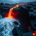 Volcanoes and the Origin of Life: When Fire and Water Spark Chemistry
 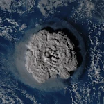 Underwater Eruptions and the Emergence of New Lands
 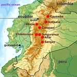 Volcanoes of Ecuador: Giants of Fire
 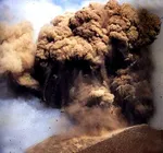 Catastrophe of a Super Eruption
 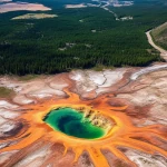 The Largest Calderas in the World: Earth's Scars
 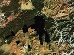 Supervolcanoes are invisible!
 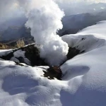 The Nevado del Ruiz volcano
 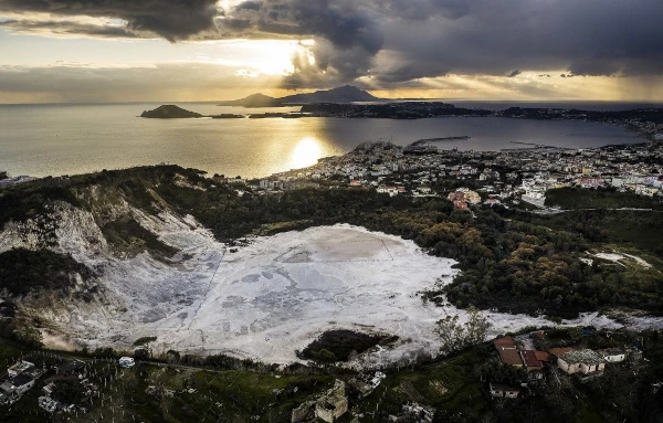 The Phlegraean Fields
 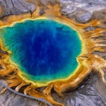 The Yellowstone Supervolcano
 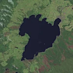 The spectacular caldera of Lake Taupo
  Chimborazo: The Highest Peak on the Planet!