Asteroids and Comets
Black Holes
Children
Chemical Elements
Constellations
Earth
Eclipses
Environment
Equations
Evolution
Exoplanets
Galaxies
Light
Matter
Moons
Nebulas
Planets and Dwarf Planets
Probes and Telescopes
Scientists
Stars
Sun
Universe
Volcanoes
Zodiac
New Articles
Shorts
Archives

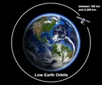 Low
Earth Orbits and their uses
Low
Earth Orbits and their uses  Pioneer, first message to extraterrestrials !
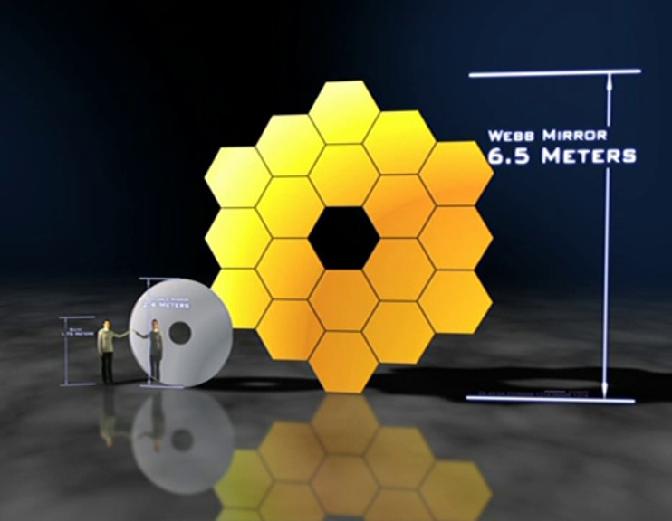
  How to see infrared images from JWST?
  Sputnik, the Russian
companion
Sputnik, the Russian
companion 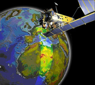 Envisat, the eye high-resolution of the Earth
 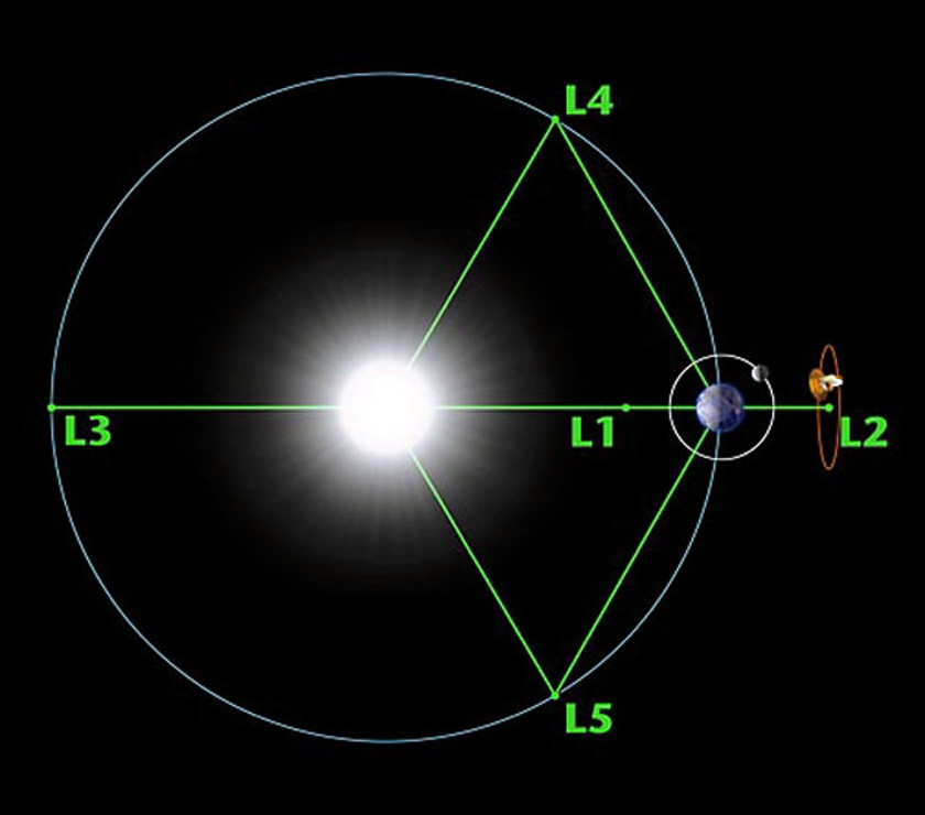 Lagrange points
  Mars Reconnaissance Orbiter
  Kepler
space telescope in search of life
Kepler
space telescope in search of life  The Eclipse Seen from Above: What Satellites Reveal About the Hidden Sun
  Why Measure Space at the Nanometer Level?
 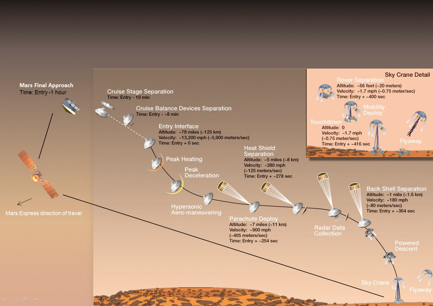 High-risk landing for Curiosity in 2012
 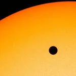 Cheops Space Telescope: A New Vision on Exoplanets
  The world of Planck
 Rosetta Space Probe: Comet Churyumov-Gerasimenko
  Satellites that measure underwater relief
 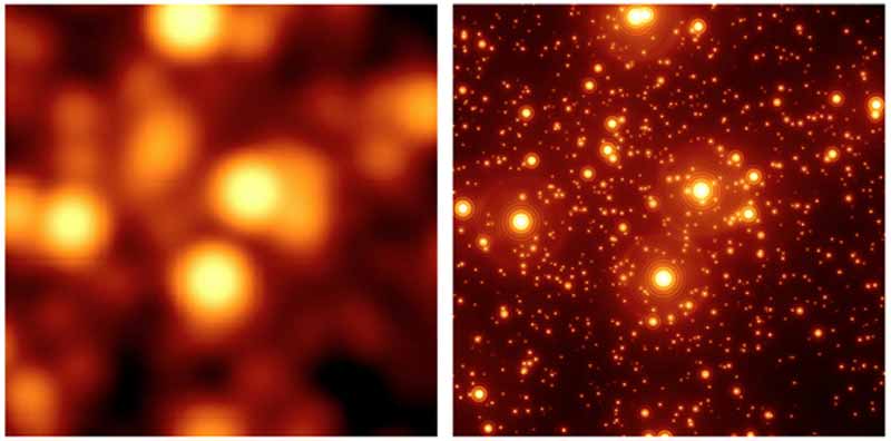 Adaptive optics and laser star
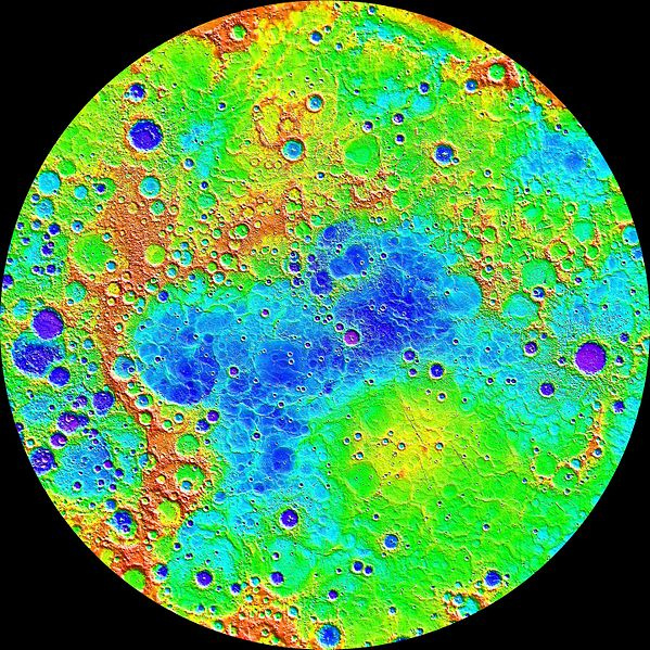
  Flyover
of Mercury by MESSENGER
Flyover
of Mercury by MESSENGER 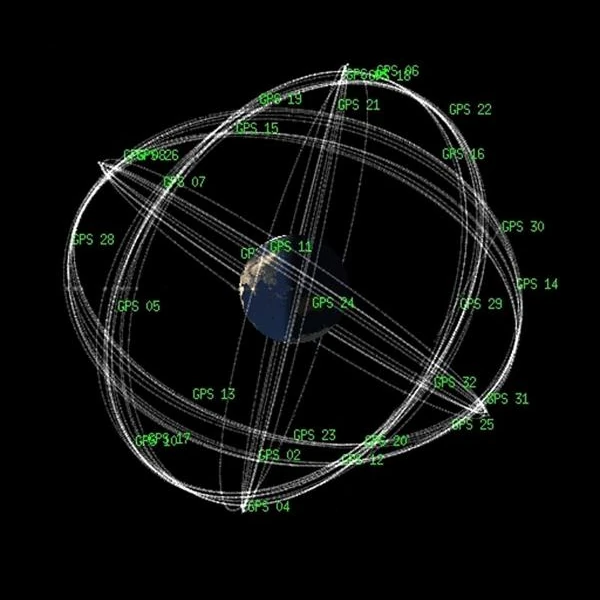 How GPS Locates
Your Position at Any Time?
How GPS Locates
Your Position at Any Time? 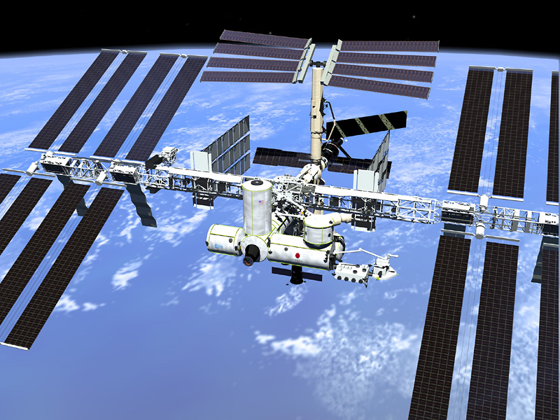 ISS in low Earth
orbit at 415 km altitude
ISS in low Earth
orbit at 415 km altitude  Voyager 1 Leaves Us Without Looking Back: The "Pale Blue Dot"
  Space
telescopes are the eyes of the Earth
Space
telescopes are the eyes of the Earth  What is a space probe?
 JWST in the
depths of space
JWST in the
depths of space  The
GAIA satellite maps the Milky Way
The
GAIA satellite maps the Milky Way  How to calculate the synchronous orbit?
  Modern cathedrals
 Mercury probes
  Space debris are increasing exponentially
 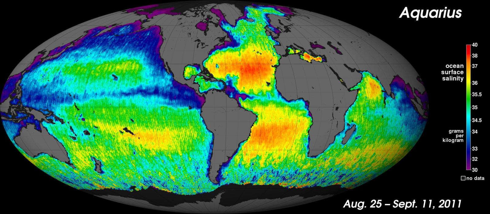 New image
of ocean salinity
New image
of ocean salinity 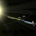 JWST: An Unprecedented Look at the First Lights of the Universe
 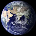 METEOSAT: A
Key Satellite for Climate Monitoring
METEOSAT: A
Key Satellite for Climate Monitoring 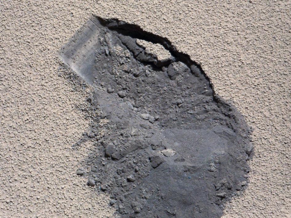 Curiosity, the first shovel, sample of Martian soil
 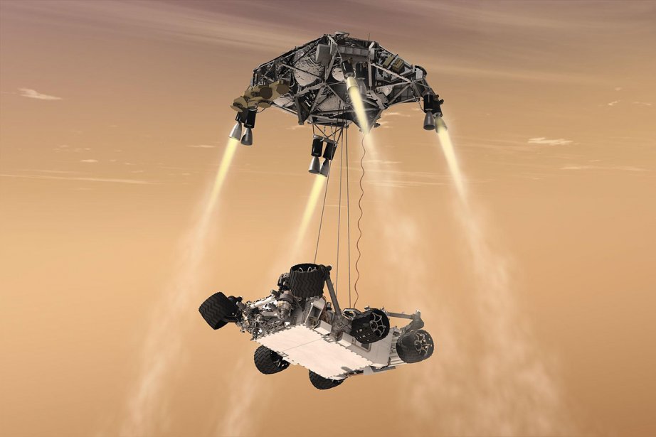 Probes of Mars
 Living on the
planet Mars
Living on the
planet Mars 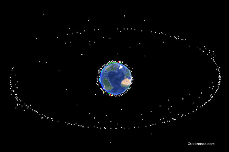 Where is the geostationary orbit?
 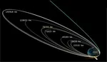 MOM,
the technological demonstration
MOM,
the technological demonstration 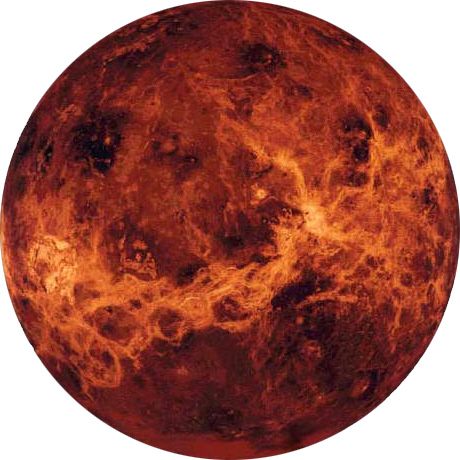 Venus probes
 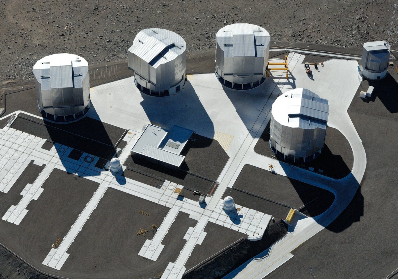 What is an interferometer?
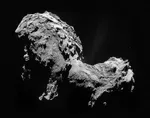 The Philae Robot and the Rosetta Comet
 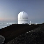 Mauna Kea Under the Stars: The CFHT Telescope in Pursuit of the Universe's Mysteries